2022 Map of Macksville
USGS Topo · Published 2022About this map
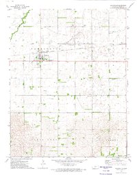
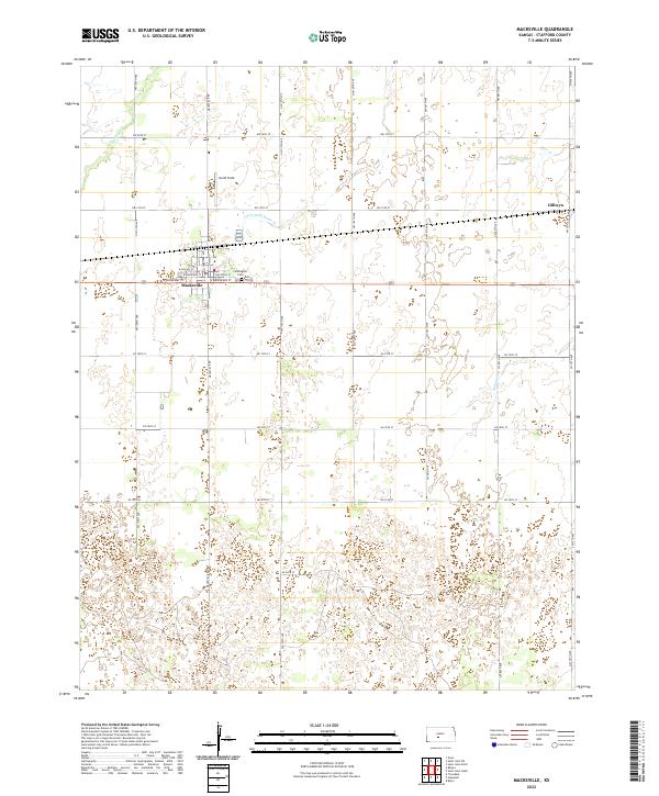
Macksville serves as the central hub of this agricultural landscape in Stafford County, where a rigid grid of section roads like NW 110th Ave and SW 20th St overlays the natural meandering of Wild Horse Cr. The town is organized around the intersection of S Main St and W Broadway St, with the local Farmington Cem situated just to the east. The terrain is characterized by numerous small depressions and wetlands, particularly noticeable in the eastern sections near Dillwyn. This settlement pattern reflects the enduring legacy of the Public Land Survey System, with township boundaries like t24s r15w defining the administrative geography. Water management and drainage are central to the area's identity, as seen in the paths of Little Wild Horse Cr and Bear Cr that cut through the surrounding farmlands and small airfields like Smith Field.
Find a feature on this map
39 named features on this map. Tap any name to fly to it.
Don’t see what you’re looking for? This feature index may not catch every label — zoom into the map to look around manually.
Map Details
Editions of this 2022 Macksville Map
This is the sole edition of this map. No revisions or reprints were ever made.