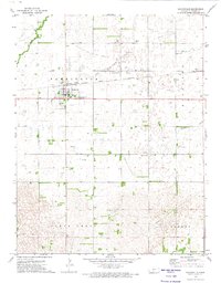
1972 Map of Macksville
USGS Topo · Published 1974About this map
Macksville serves as the primary hub of this Stafford County landscape, where the grid of a settled Kansas town meets the sprawling energy and agricultural interests of the early 1970s. The town's infrastructure is clearly defined, from the Water Tank and Sewage Disposal to the Township Cem on the eastern edge. Industry is heavily represented by the Macksville Oil and Gas Field and the Kraeger Oil and Field, which dot the terrain with numerous wells and pipelines alongside water bodies like Wild Horse Creek and Spring Creek. Transport and commerce are tied to the Atchison Topeka and Santa Fe railroad, which parallels the main highway through town, and the Smith Landing Strip to the north. Smaller settlements like Dillwyn and expansive areas like Richland and Farmington show the distribution of ranching and oil production across the plains.
Find a feature on this map
17 named features on this map. Tap any name to fly to it.
Don’t see what you’re looking for? This feature index may not catch every label — zoom into the map to look around manually.
Map Details
Editions of this 1972 Macksville Map
This is the sole edition of this map. No revisions or reprints were ever made.
Other maps of this area

1889 · Larned
USGS Topo · 1:125,000

1889 · Kinsley
USGS Topo · 1:125,000

1891 · Great Bend
USGS Topo · 1:125,000

1891 · Larned
USGS Topo · 1:125,000

1892 · Kinsley
USGS Topo · 1:125,000

1892 · Pratt
USGS Topo · 1:125,000

1893 · Great Bend
USGS Topo · 1:125,000

1894 · Kinsley
USGS Topo · 1:125,000

1894 · Pratt
USGS Topo · 1:125,000

1955 · Great Bend
USGS Topo · 1:250,000