2022 Map of Mackville
USGS Topo · Published 2022About this map
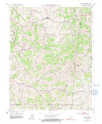
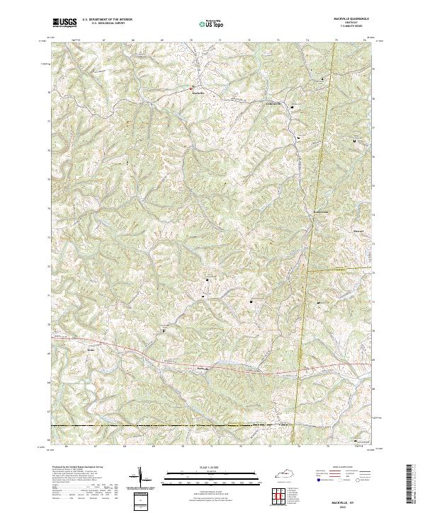
Mackville and Texas anchor this rural landscape in western Washington County, where the hills are defined by the winding waters of the Beech Fork and Deep Creek. The map documents a deeply established agricultural community, evidenced by numerous family burial grounds such as Cull Cem and the Mc Mullin Cem. These sites, along with small crossroads like Pottsville and Jenkinsville, trace the early settlement patterns of the region. The terrain is a network of ridges and hollows, where long-established routes like Battle Rd and Harrodsburg Rd follow the natural topography. Along the eastern edge, the boundary between Washington, Mercer, and Boyle counties follows high ground and stream beds, passing through the quiet area of Stewart and the drainage of Pallis Run.
Find a feature on this map
89 named features on this map. Tap any name to fly to it.
Don’t see what you’re looking for? This feature index may not catch every label — zoom into the map to look around manually.
Map Details
Editions of this 2022 Mackville Map
This is the sole edition of this map. No revisions or reprints were ever made.