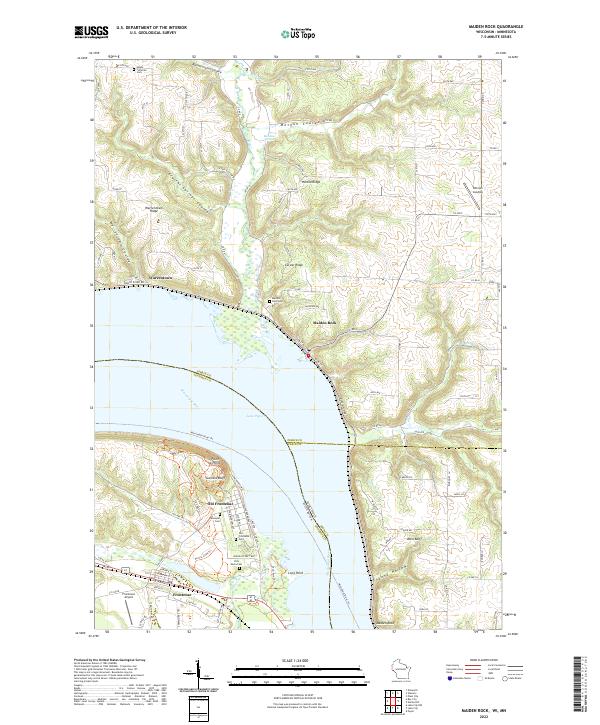
2022 Map of Maiden Rock
USGS Topo · Published 2022About this map
Lake Pepin dominates this section of the Mississippi River, where the borders of Wisconsin and Minnesota meet amidst dramatic bluff country. On the Minnesota shore, the historic core of Old Frontenac is preserved alongside its modern counterpart, Frontenac, characterized by a grid of streets tucked beneath the heights of Garrard Bluff. Across the wide expanse of the river, the village of Maiden Rock sits at the base of the Wisconsin hills. The map highlights a landscape of deep ravines, or coulees, such as Bremenington Coulee and Morgan Coulee, which cut through the high ridges. Genealogists will find numerous burial sites documented, including the Old Frontenac Cem, Villa Maria Cem, and Maiden Rock Cem. This contemporary record shows how established settlements like Warrentown and Ottman Landing continue to interface with the river's shoreline and the arterial Great River Rd.
Find a feature on this map
52 named features on this map. Tap any name to fly to it.
Don’t see what you’re looking for? This feature index may not catch every label — zoom into the map to look around manually.
Map Details
Editions of this 2022 Maiden Rock Map
This is the sole edition of this map. No revisions or reprints were ever made.
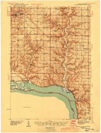
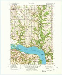
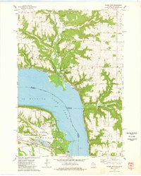
Historical Maps of Maiden Rock Through Time
4 maps found