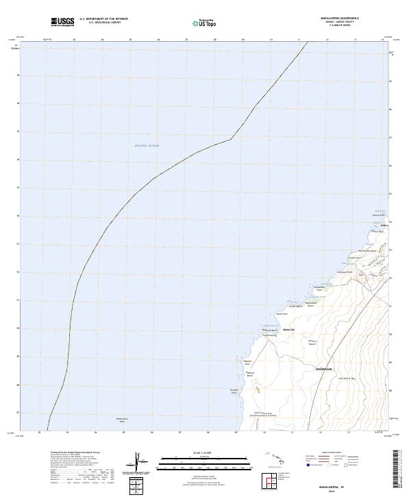
2024 Map of Makalawena
USGS Topo · Published 2024About this map
The Lava Flow of 1801 dominates the coastal topography of this North Kona region, illustrating the volcanic foundations of the Island of Hawai‘i. Along the shoreline, the map details a series of coves and points, including Kahoiawa Bay and Kikaua Point, which frame the modern developments at Kūki‘o. Inland, the landscape rises toward the cinder cone of Kuili, while the coast is marked by culturally significant sites like ‘Opae‘ula Pond and the extensive sands of Makalawena Beach. This survey records the intersection of geological history and aviation infrastructure, anchored by the Ellison Onizuka Kona International Airport at Keahole at the southern edge. Local transit is represented by recent residential corridors such as Maniniowali Dr and Alapii Kula Dr, which navigate the rugged terrain between the shore and the higher slopes of Kaiminani.
Find a feature on this map
36 named features on this map. Tap any name to fly to it.
Don’t see what you’re looking for? This feature index may not catch every label — zoom into the map to look around manually.
Map Details
Editions of this 2024 Makalawena Map
This is the sole edition of this map. No revisions or reprints were ever made.
Other maps of this area

1928 · Puako
USGS Topo · 1:62,500

1928 · Kailua
USGS Topo · 1:62,500

1954 · Hawaii North
USGS Topo · 1:250,000

1959 · Hawaii North
USGS Topo · 1:250,000

1959 · Kiholo
USGS Topo · 1:24,000
1959 · Anaehoomalu
USGS Topo · 1:24,000

1959 · Makalawena
USGS Topo · 1:24,000

1959 · Keahole Point
USGS Topo · 1:24,000

1959 · Kailua
USGS Topo · 1:24,000

1961 · Hawaii North
USGS Topo · 1:250,000