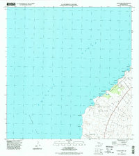
1996 Map of Makalawena
USGS Topo · Published 1998About this map
Lava Flow of 1801 dominates the coastal topography of this West Hawaii landscape, illustrating the raw volcanic history that defines the North Kona district. The shoreline is punctuated by numerous points and small bays, including Kua Bay and Mahaiula Bay, where small settlements like Makalawena and Mahaiula once sat at the edge of the Pacific Ocean. Within the protected bounds of Kona Coast State Park, the map reveals sensitive ecological and cultural features such as Opaeula Pond and a local Cem, providing evidence of historical habitation in an area later defined by state conservation efforts.
Find a feature on this map
34 named features on this map. Tap any name to fly to it.
Don’t see what you’re looking for? This feature index may not catch every label — zoom into the map to look around manually.
Map Details
Editions of this 1996 Makalawena Map
This is the sole edition of this map. No revisions or reprints were ever made.
Other maps of this area

1928 · Puako
USGS Topo · 1:62,500

1928 · Kailua
USGS Topo · 1:62,500

1954 · Hawaii North
USGS Topo · 1:250,000

1959 · Hawaii North
USGS Topo · 1:250,000

1959 · Kiholo
USGS Topo · 1:24,000
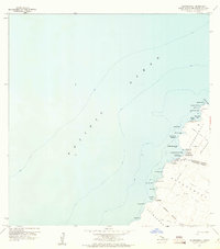
1959 · Anaehoomalu
USGS Topo · 1:24,000

1959 · Makalawena
USGS Topo · 1:24,000

1959 · Keahole Point
USGS Topo · 1:24,000

1959 · Kailua
USGS Topo · 1:24,000

1961 · Hawaii North
USGS Topo · 1:250,000