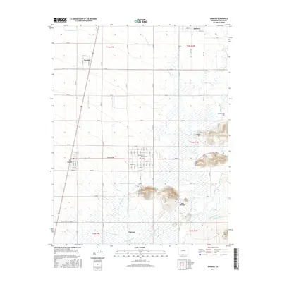
2016 Map of Manassa
USGS Topo · Published 2016About this map
Manassa serves as the central hub of this high-elevation agricultural landscape, where an intricate web of irrigation infrastructure defines the pattern of life. The map details a sophisticated network of water management, including the Sanford-Richfield-Ephraim-Ditch, Manassa Eastfield Ditch, and the W Lone Star Lateral, all drawing from the Conejos River and its branches. This reliance on gravity-fed water is evident in the placement of settlements like Romeo and Bountiful, which are situated along these vital lifelines.
Find a feature on this map
65 named features on this map. Tap any name to fly to it.
Don’t see what you’re looking for? This feature index may not catch every label — zoom into the map to look around manually.
Map Details
Editions of this 2016 Manassa Map
This is the sole edition of this map. No revisions or reprints were ever made.
Other maps of this area

1922 · Conejos
USGS Topo · 1:125,000

1945 · Durango
USGS Topo · 1:250,000

1953 · Durango
USGS Topo · 1:250,000

1954 · Durango
USGS Topo · 1:250,000

1954 · Trinidad
USGS Topo · 1:250,000

1955 · Trinidad
USGS Topo · 1:250,000

1958 · Trinidad
USGS Topo · 1:250,000

1959 · Trinidad
USGS Topo · 1:250,000

1961 · Durango
USGS Topo · 1:250,000

1963 · Durango
USGS Topo · 1:250,000