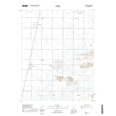
2019 Map of Manassa
USGS Topo · Published 2019About this map
Manassa and Romeo anchor this high-desert agricultural landscape in Conejos County, defined by a complex network of irrigation that draws from the Conejos River and Rio San Antonio. The engineering of the valley is evident in the dense grid of waterways including the San Luis Ditch, Manassa Eastfield Ditch, and Richfield Canal, which sustain the small settlements of Bountiful and Espinosa. Genealogists will find significant local history at several burial sites, such as the Sowards Cem and the distinctive Old Manassa Cem and New Manassa Cem. To the east, the terrain rises toward the San Luis Hills and Piñon Hills, offering a sharp contrast to the irrigated flats of Greasewood Flat. The map provides a contemporary record of these established Mormon settlements and their enduring reliance on mountain snowmelt channeled through historical ditch systems.
Find a feature on this map
61 named features on this map. Tap any name to fly to it.
Don’t see what you’re looking for? This feature index may not catch every label — zoom into the map to look around manually.
Map Details
Editions of this 2019 Manassa Map
This is the sole edition of this map. No revisions or reprints were ever made.
Other maps of this area

1922 · Conejos
USGS Topo · 1:125,000

1945 · Durango
USGS Topo · 1:250,000

1953 · Durango
USGS Topo · 1:250,000

1954 · Durango
USGS Topo · 1:250,000

1954 · Trinidad
USGS Topo · 1:250,000

1955 · Trinidad
USGS Topo · 1:250,000

1958 · Trinidad
USGS Topo · 1:250,000

1959 · Trinidad
USGS Topo · 1:250,000

1961 · Durango
USGS Topo · 1:250,000

1963 · Durango
USGS Topo · 1:250,000