
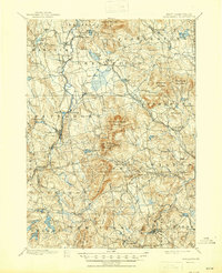
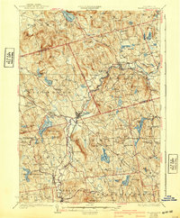
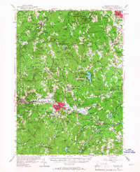
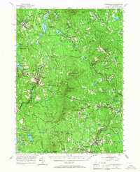
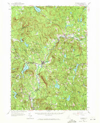
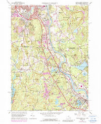
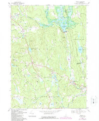
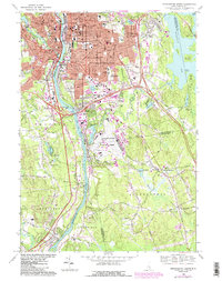
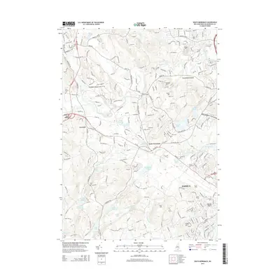
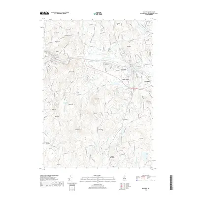
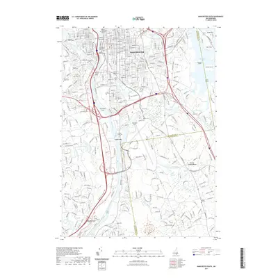
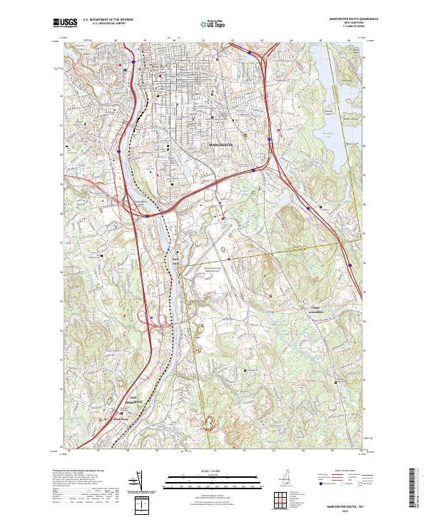
1977 Map of Manchester South
USGS Topo · Published 1981About this map
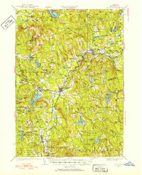
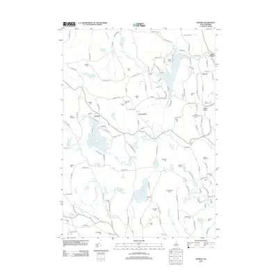
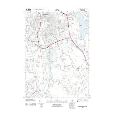
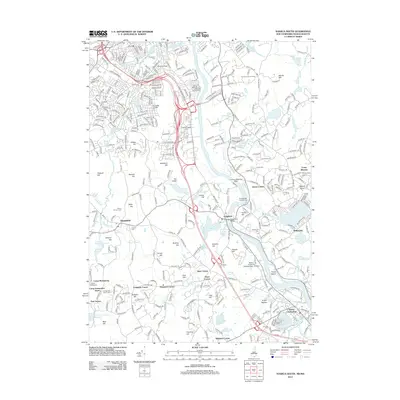
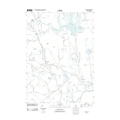
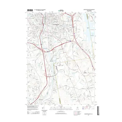
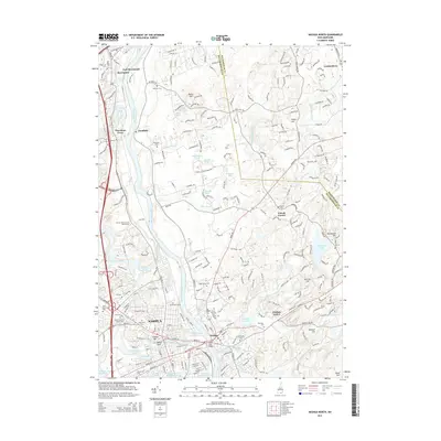
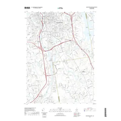
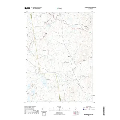
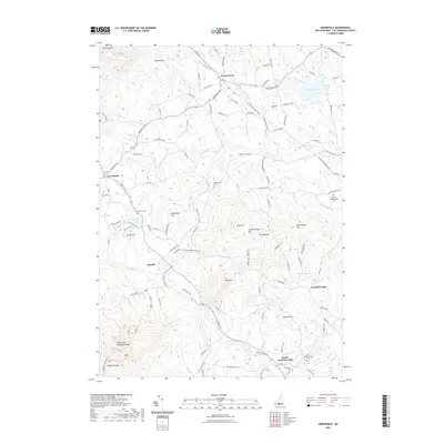
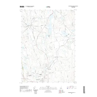
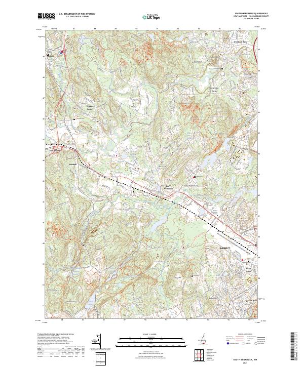
The Merrimack River serves as the central artery of this orthophotomap, which utilizes 1977 aerial photography to document the landscape south of Manchester. Unlike a standard topographic map, this imagery reveals the dense residential and industrial patterns of late-1970s New Hampshire with photographic precision. The settlement of Reeds Ferry is visible along the riverbank, showing the evolution of this historic crossing point as it integrated into the modern suburban corridor. Near the center of the image, Pine Island Pond stands out against the developing infrastructure, providing a clear view of how water bodies and terrain dictated the placement of large-scale facilities and transportation routes during this era of growth in Hillsborough County.
Find a feature on this map
3 named features on this map. Tap any name to fly to it.
Don’t see what you’re looking for? This feature index may not catch every label — zoom into the map to look around manually.
Map Details
Editions of this 1977 Manchester South Map
This is the sole edition of this map. No revisions or reprints were ever made.
Historical Maps of Manchester Through Time
95 maps found
1900 Peterboro
Hillsborough County, NH

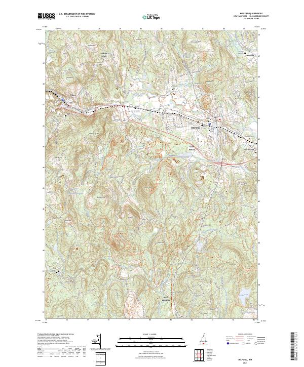
1906 Milford
Hillsborough County, NH
1926 Hillsboro
Hillsborough County, NH
1929 Hillsboro
Hillsborough County, NH
1953 Milford
Hillsborough County, NH
1953 Peterborough
Hillsborough County, NH
1957 Hillsboro
Hillsborough County, NH
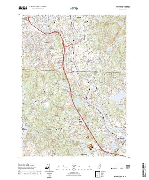
1965 Nashua South
Hillsborough County, NH
1967 Weare
Hillsborough County, NH
1968 Manchester South
Hillsborough County, NH
1968 Milford
Hillsborough County, NH
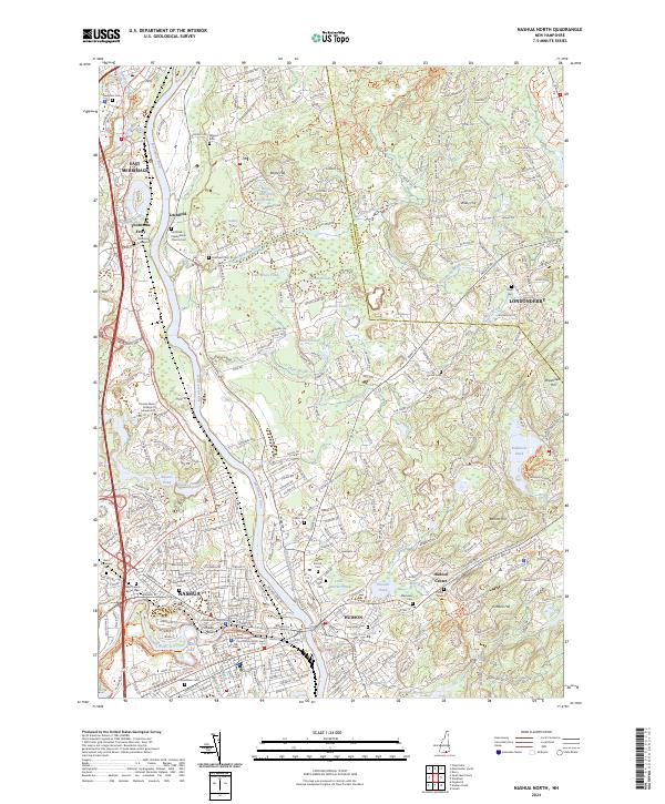
1968 Nashua North
Hillsborough County, NH
1968 South Merrimack
Hillsborough County, NH
1977 Manchester South
Hillsborough County, NH

1977 Nashua North
Hillsborough County, NH

1987 Deering
Hillsborough County, NH

1987 Greenfield
Hillsborough County, NH

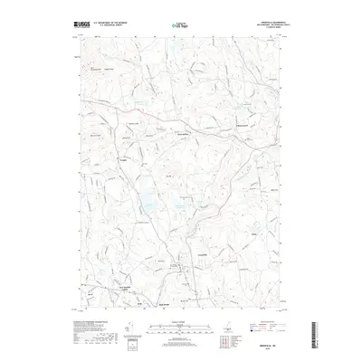
1987 Greenville
Hillsborough County, NH

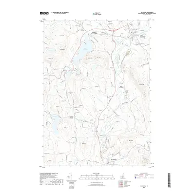
1987 Hillsboro
Hillsborough County, NH

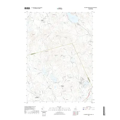
1987 Hillsboro Upper Village
Hillsborough County, NH

1987 Peterborough North
Hillsborough County, NH

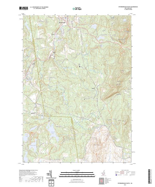
1987 Peterborough South
Hillsborough County, NH

1995 Greenfield
Hillsborough County, NH

1995 Hillsboro
Hillsborough County, NH

1995 Weare
Hillsborough County, NH

1997 Greenville
Hillsborough County, NH

1997 Peterborough North
Hillsborough County, NH

1997 Peterborough South
Hillsborough County, NH

1998 Deering
Hillsborough County, NH

1998 Hillsboro Upper Village
Hillsborough County, NH
2012 Deering
Hillsborough County, NH
2012 Greenfield
Hillsborough County, NH
2012 Greenville
Hillsborough County, NH
2012 Hillsboro
Hillsborough County, NH
2012 Hillsboro Upper Village
Hillsborough County, NH
2012 Manchester South
Hillsborough County, NH
2012 Milford
Hillsborough County, NH
2012 Nashua North
Hillsborough County, NH
2012 Nashua South
Hillsborough County, NH
2012 Peterborough North
Hillsborough County, NH
2012 Peterborough South
Hillsborough County, NH
2012 South Merrimack
Hillsborough County, NH
2012 Weare
Hillsborough County, NH
2015 Deering
Hillsborough County, NH
2015 Greenfield
Hillsborough County, NH
2015 Greenville
Hillsborough County, NH
2015 Hillsboro
Hillsborough County, NH
2015 Hillsboro Upper Village
Hillsborough County, NH
2015 Manchester South
Hillsborough County, NH
2015 Milford
Hillsborough County, NH
2015 Nashua North
Hillsborough County, NH
2015 Nashua South
Hillsborough County, NH
2015 Peterborough North
Hillsborough County, NH
2015 Peterborough South
Hillsborough County, NH
2015 South Merrimack
Hillsborough County, NH
2015 Weare
Hillsborough County, NH
2018 Deering
Hillsborough County, NH
2018 Greenfield
Hillsborough County, NH
2018 Greenville
Hillsborough County, NH
2018 Hillsboro
Hillsborough County, NH
2018 Hillsboro Upper Village
Hillsborough County, NH
2018 Manchester South
Hillsborough County, NH
2018 Milford
Hillsborough County, NH
2018 Nashua North
Hillsborough County, NH
2018 Nashua South
Hillsborough County, NH
2018 Peterborough North
Hillsborough County, NH
2018 Peterborough South
Hillsborough County, NH
2018 South Merrimack
Hillsborough County, NH
2018 Weare
Hillsborough County, NH
2021 Deering
Hillsborough County, NH
2021 Greenfield
Hillsborough County, NH
2021 Greenville
Hillsborough County, NH
2021 Hillsboro
Hillsborough County, NH
2021 Hillsboro Upper Village
Hillsborough County, NH
2021 Manchester South
Hillsborough County, NH
2021 Milford
Hillsborough County, NH
2021 Nashua North
Hillsborough County, NH
2021 Nashua South
Hillsborough County, NH
2021 Peterborough North
Hillsborough County, NH
2021 Peterborough South
Hillsborough County, NH
2021 South Merrimack
Hillsborough County, NH
2021 Weare
Hillsborough County, NH
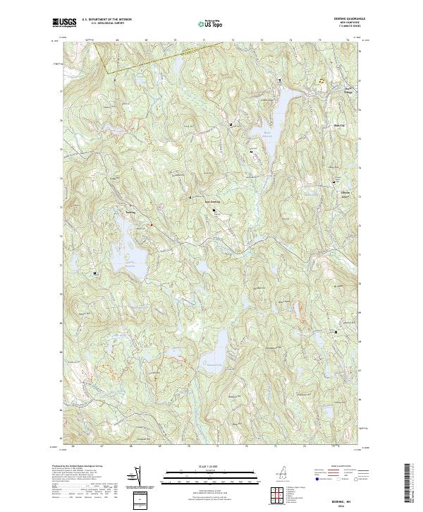
2024 Deering
Hillsborough County, NH

2024 Greenfield
Hillsborough County, NH
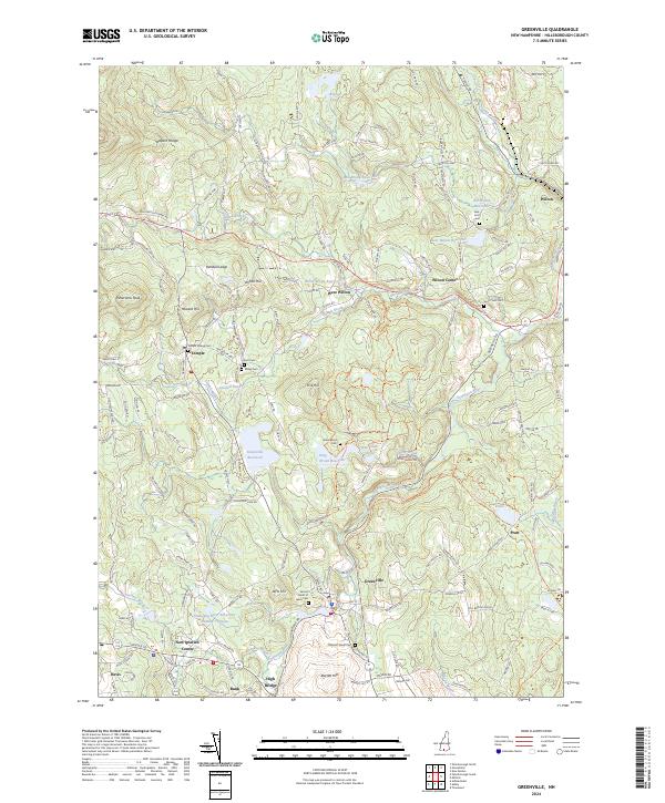
2024 Greenville
Hillsborough County, NH

2024 Hillsboro
Hillsborough County, NH
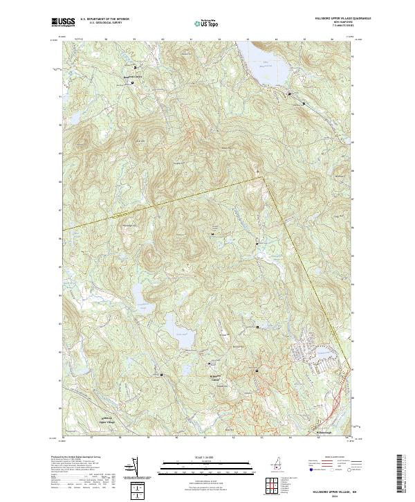
2024 Hillsboro Upper Village
Hillsborough County, NH
2024 Manchester South
Hillsborough County, NH
2024 Milford
Hillsborough County, NH
2024 Nashua North
Hillsborough County, NH
2024 Nashua South
Hillsborough County, NH

2024 Peterborough North
Hillsborough County, NH
2024 Peterborough South
Hillsborough County, NH
2024 South Merrimack
Hillsborough County, NH
2024 Weare
Hillsborough County, NH