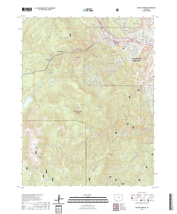
2022 Map of Manitou Springs
USGS Topo · Published 2022About this map
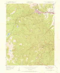
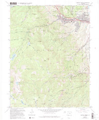
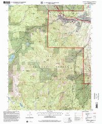
Manitou Springs serves as the gateway to the Front Range, where the steep ascent of the Manitou & Pikes Peak Ry begins its climb toward the clouds. The landscape is defined by dramatic elevation changes, from the settlement at Minnehaha to the high-altitude peaks of Mt Manitou and Cameron Cone. This modern survey details the intricate network of historic trails and specialized paths, such as the Manitou Incline Summit Trl and Barr Trl, which have long served hikers and tourists. The area is also noted for its geologic landmarks, including the Siamese Twins and Gog Rock. To the south, the terrain falls away into deep drainage systems like South Cheyenne Canyon and Buffalo Canyon, where water features such as Seven Falls and Silver Cascade Falls mark the rugged descent of the mountain creeks toward the plains of Colorado Springs.
Find a feature on this map
156 named features on this map. Tap any name to fly to it.
Don’t see what you’re looking for? This feature index may not catch every label — zoom into the map to look around manually.
Map Details
Editions of this 2022 Manitou Springs Map
This is the sole edition of this map. No revisions or reprints were ever made.
Historical Maps of Midway Through Time
4 maps found