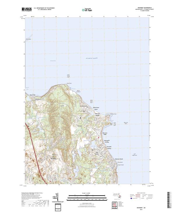
2024 Map of Manomet
USGS Topo · Published 2024About this map
The Pinehills and Manomet Hill dominate this coastal section of Plymouth, where the upland forest meets a densely settled shoreline along the Atlantic. The landscape is defined by its numerous glacial kettle ponds and modern water management features like Whipple Reservoir and Indian Brook Reservoir. Significant local heritage sites are noted across the terrain, including the Old Indian Burying Ground Cem and Manomet Cem, reflecting centuries of habitation near the coast.
Find a feature on this map
99 named features on this map. Tap any name to fly to it.
Don’t see what you’re looking for? This feature index may not catch every label — zoom into the map to look around manually.
Map Details
Editions of this 2024 Manomet Map
This is the sole edition of this map. No revisions or reprints were ever made.
Other maps of this area

1885 · Duxbury
USGS Topo · 1:62,500

1886 · Plymouth
USGS Topo · 1:62,500

1888 · Duxbury
USGS Topo · 1:62,500

1889 · Plymouth
USGS Topo · 1:62,500

1893 · Duxbury
USGS Topo · 1:62,500

1894 · Plymouth
USGS Topo · 1:62,500

1918 · Duxbury
USGS Topo · 1:62,500
1921 · Plymouth
USGS Topo · 1:62,500
1933 · Sagamore
USGS Topo · 1:24,000
1934 · Plymouth
USGS Topo · 1:24,000
Featured Places
- Plymouth, MA
- Churchill Landing, Plymouth
- Fishermans Landing, Plymouth
- Manomet Beach, Plymouth
- Beach Park, Plymouth