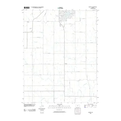
2009 Map of Mantey
USGS Topo · Published 2009About this map
Mantey serves as the focal point of this agricultural landscape in Linn County, where section-line roads define the movement of rural life. The settlement pattern is characterized by family burial grounds, including Shaw Cemetery and Curry Cemetery, which offer valuable data for genealogical research in this part of eastern Kansas. The terrain is deeply influenced by the dendritic drainage patterns of the Little Osage River and its tributaries, such as Elk Creek and Lost Creek, which snake through the grid of county roads like Lewis Rd and S Knapp Rd. While most of the area remains dominated by large tracts of farmland, the northern portion of the map shows modern residential development around Mine Creek, with clustered neighborhoods like those on Sunset Ln and Quail Ridge Rd introducing a suburban density to the traditionally agrarian landscape.
Find a feature on this map
52 named features on this map. Tap any name to fly to it.
Don’t see what you’re looking for? This feature index may not catch every label — zoom into the map to look around manually.
Map Details
Editions of this 2009 Mantey Map
This is the sole edition of this map. No revisions or reprints were ever made.
Other maps of this area

1884 · Fort Scott
USGS Topo · 1:125,000

1886 · Fort Scott
USGS Topo · 1:125,000

1887 · Mound City
USGS Topo · 1:125,000

1893 · Fort Scott
USGS Topo · 1:125,000

1893 · Mound City
USGS Topo · 1:125,000

1947 · Lawrence
USGS Topo · 1:250,000

1947 · Joplin
USGS Topo · 1:250,000

1949 · Joplin
USGS Topo · 1:250,000

1950 · Lawrence
USGS Topo · 1:250,000

1954 · Joplin
USGS Topo · 1:250,000