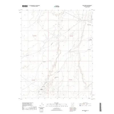
2018 Map of Many Farms SW
USGS Topo · Published 2018About this map
Carson Mesa defines the western landscape of this high-desert region, overlooking the broad Chinle Valley to the east. This 2018 survey documents a remote section of the Navajo Nation where water remains the primary driver of settlement and navigation. Vital water sources like Alamo Spring, Sunrise Spring, and Scott Spring are scattered across the terrain, supporting local life along Indian Rte 8082 and Indian Rte 8083. The edge of Many Farms is visible in the northeast, while the southern reaches feature the Coyote Springs area. The topographic detail follows the drainage patterns of Hipbone Wash and Black Mountain Wash, illustrating the complex erosional features that characterize this corner of Apache County.
Find a feature on this map
18 named features on this map. Tap any name to fly to it.
Don’t see what you’re looking for? This feature index may not catch every label — zoom into the map to look around manually.
Map Details
Editions of this 2018 Many Farms SW Map
This is the sole edition of this map. No revisions or reprints were ever made.
Other maps of this area

1892 · Canyon De Chelly
USGS Topo · 1:250,000

1954 · Shiprock
USGS Topo · 1:250,000

1955 · Chinle 4 NE
USGS Topo · 1:24,000

1958 · Shiprock
USGS Topo · 1:250,000

1959 · Shiprock
USGS Topo · 1:250,000
1968 · Many Farms NE
USGS Topo · 1:24,000

1968 · Many Farms SW
USGS Topo · 1:24,000

1968 · Windy Valley
USGS Topo · 1:24,000
1968 · Many Farms
USGS Topo · 1:24,000
1968 · Rough Rock
USGS Topo · 1:24,000