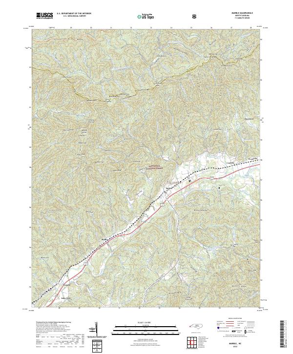
2022 Map of Marble
USGS Topo · Published 2022About this map
Marble and the Valley River corridor define the industrial and agricultural heart of this portion of Cherokee County. The landscape is marked by small settlements like Maltby, Tomotla, and the legacy of regional industry at Coalville and Woodville. Significant portions of the northern and southern terrain are protected within the Nantahala National Forest, where steep ridges such as Sassafras Ridge and Fishermare Ridge overlook the valley floor. Cultural and genealogical markers are found at Moss Cem and Parker Cem, while the historic Webb Mill and the Sales Ford river crossing point to the area's long-standing reliance on local waterways. Educational and vocational development is represented by the Cherokee County Center for Applied Technology, situated near the primary transport artery of Route 19 74.
Find a feature on this map
146 named features on this map. Tap any name to fly to it.
Don’t see what you’re looking for? This feature index may not catch every label — zoom into the map to look around manually.
Map Details
Editions of this 2022 Marble Map
This is the sole edition of this map. No revisions or reprints were ever made.
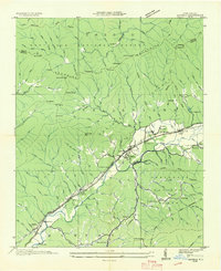
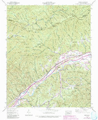
Historical Maps of Tomotla Through Time
3 maps found