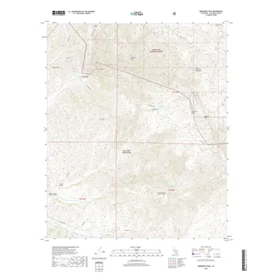
2018 Map of Margarita Peak
USGS Topo · Published 2018About this map
Margarita Peak stands as the dominant summit in the Santa Margarita Mountains, anchoring a landscape where military training grounds and protected wilderness meet. The southern half of this area is occupied by MCB Camp Pendleton, showing a network of service roads such as Basilone Rd and Airfield Rd cutting through the complex canyon systems of North Fork San Onofre Canyon and South Fork San Onofre Canyon.
Find a feature on this map
35 named features on this map. Tap any name to fly to it.
Don’t see what you’re looking for? This feature index may not catch every label — zoom into the map to look around manually.
Map Details
Editions of this 2018 Margarita Peak Map
This is the sole edition of this map. No revisions or reprints were ever made.
Other maps of this area

1901 · Southern California Sheet No. 1
USGS Topo · 1:250,000

1901 · Elsinore
USGS Topo · 1:125,000

1901 · San Luis Rey
USGS Topo · 1:125,000

1902 · Capistrano
USGS Topo · 1:125,000

1902 · Corona
USGS Topo · 1:125,000

1904 · Southern California Sheet No. 2
USGS Topo · 1:250,000

1904 · Southern California Sheet No. 1
USGS Topo · 1:250,000

1906 · Capistrano
USGS Topo · 1:125,000

1941 · Margarita Peak
USGS Topo · 1:62,500

1942 · Lake Elsinore
USGS Topo · 1:62,500