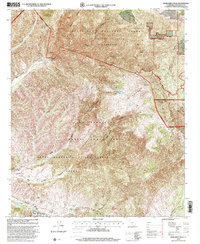
1997 Map of Margarita Peak
USGS Topo · Published 2000About this map
Camp Pendleton Marine Corps Base dominates the southern half of this landscape, where the rugged terrain is marked by numerous observation towers and a series of firing ranges. This military presence sits within the historic boundaries of the Santa Margarita y Las Flores Grant, a massive ranching legacy of the Mexican land grant era. To the north, the topography transitions into the protected wildlands of the Cleveland National Forest and the San Mateo Canyon Wilderness, centered around the high point of Margarita Peak.
Find a feature on this map
35 named features on this map. Tap any name to fly to it.
Don’t see what you’re looking for? This feature index may not catch every label — zoom into the map to look around manually.
Map Details
Editions of this 1997 Margarita Peak Map
This is the sole edition of this map. No revisions or reprints were ever made.
Other maps of this area

1901 · Southern California Sheet No. 1
USGS Topo · 1:250,000

1901 · Elsinore
USGS Topo · 1:125,000

1901 · San Luis Rey
USGS Topo · 1:125,000

1902 · Capistrano
USGS Topo · 1:125,000

1902 · Corona
USGS Topo · 1:125,000

1904 · Southern California Sheet No. 2
USGS Topo · 1:250,000

1904 · Southern California Sheet No. 1
USGS Topo · 1:250,000

1906 · Capistrano
USGS Topo · 1:125,000

1941 · Margarita Peak
USGS Topo · 1:62,500

1942 · Lake Elsinore
USGS Topo · 1:62,500