
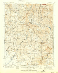
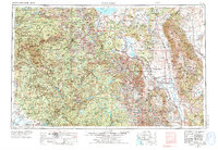
1948 Map of Mariposa
USGS Topo · Published 1951About this map
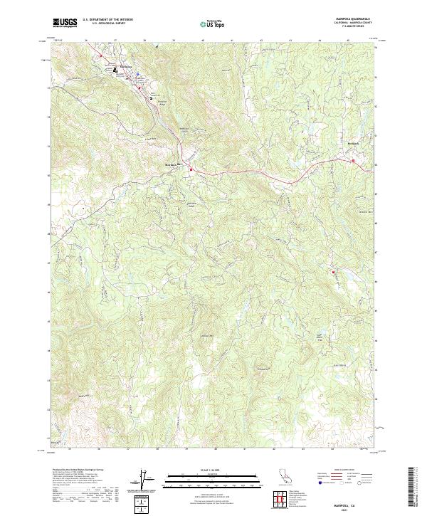
Mariposa and the high Sierra Nevada are documented here just after the war, showing a landscape defined by its transition from the Central Valley foothills to the jagged peaks of the Cathedral Range. The map details the early post-war infrastructure of Yosemite National Park, featuring the Glacier Point Hotel and the Crane Flat Ranger Station along the historic Tioga Road. Further east, the high desert and alpine lake country around Mono Lake and Crowley Lake are clearly delineated, including the complex water systems of the Long Valley Reservoir and Hetch Hetchy Reservoir. Local history is preserved through labels for smaller mining and timber era settlements like Mormon Bar, Ahwahnee, and Nipinnawasee. The presence of the Southern Pacific RR near Raymond and Knowles Junction illustrates the transportation networks that linked these mountain communities to the valley below, while industrial markers like the Blind Spring Mill point to the region's mineral heritage.
Find a feature on this map
175 named features on this map. Tap any name to fly to it.
Don’t see what you’re looking for? This feature index may not catch every label — zoom into the map to look around manually.
Map Details
Editions of this 1948 Mariposa Map
This is the sole edition of this map. No revisions or reprints were ever made.
Historical Maps of Mammoth Lakes Through Time
11 maps found
1912 Mariposa
Mariposa County, CA
1947 Mariposa
Mariposa County, CA
1947 Mariposa
Mariposa County, CA
1947 Mariposa
Mariposa County, CA
1948 Mariposa
Mariposa County, CA
1957 Mariposa
Mariposa County, CA

1963 Mariposa
Mariposa County, CA
2012 Mariposa
Mariposa County, CA
2015 Mariposa
Mariposa County, CA
2018 Mariposa
Mariposa County, CA
2021 Mariposa
Mariposa County, CA
Featured Locations
- Mammoth Lakes, CA
- Coarsegold, CA
- Oakhurst, CA
- Bishop, CA
- Dixon Lane–Meadow Creek, Dixon Lane-Meadow Creek