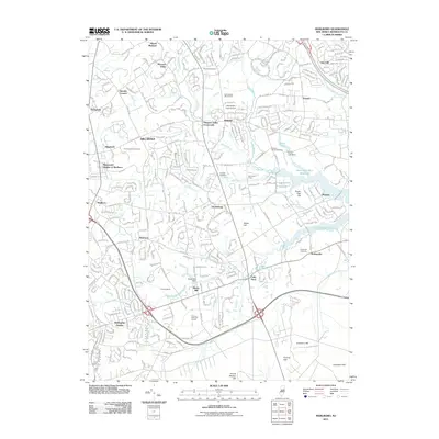
2011 Map of Marlboro
USGS Topo · Published 2011About this map
Swimming River Reservoir dominates the eastern landscape of this Monmouth County region, its fingers reaching into several watersheds near Phalanx and Scobeyville. The map illustrates the transition from traditional agriculture to suburban density, where landmarks like Eastmont Orchards and Romanessin Brook Farm persist alongside expanding residential clusters in Hillsdale and Monmouth Heights at Marlboro. For genealogists and local historians, several small burial grounds are preserved on this sheet, including the Smock Family Cemetery and the State Hospital Cemetery. Water management and early industry are evident at the Bucks Mill Dam on Yellow Brook and the Marlu Lake Dam. Significant relief is provided by the Hominy Hills to the south and Stone Hill, providing a backdrop to established crossroads like Vanderburg and Colts Neck.
Find a feature on this map
49 named features on this map. Tap any name to fly to it.
Don’t see what you’re looking for? This feature index may not catch every label — zoom into the map to look around manually.
Map Details
Editions of this 2011 Marlboro Map
This is the sole edition of this map. No revisions or reprints were ever made.
Other maps of this area

1888 · New Brunswick
USGS Topo · 1:62,500

1888 · Asbury Park
USGS Topo · 1:62,500

1888 · Cassville
USGS Topo · 1:62,500

1888 · Sandy Hook
USGS Topo · 1:62,500

1893 · New Brunswick
USGS Topo · 1:62,500

1893 · Sandy Hook
USGS Topo · 1:62,500

1893 · Asbury Park
USGS Topo · 1:62,500

1894 · Cassville
USGS Topo · 1:62,500

1900 · Cassville
USGS Topo · 1:62,500

1901 · New Brunswick
USGS Topo · 1:62,500
Featured Places
- Middletown Township, NJ
- Howell Township, NJ
- Marlboro Township, NJ
- Freehold Township, NJ
- Wall Township, NJ