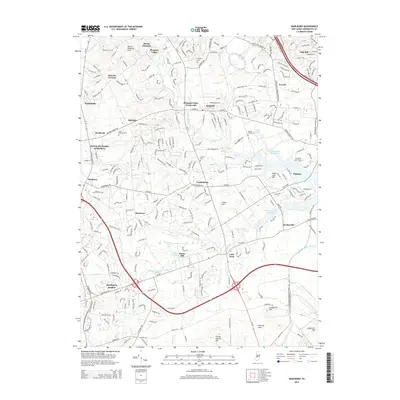
2014 Map of Marlboro
USGS Topo · Published 2014About this map
Colts Neck and the surrounding Monmouth County countryside are mapped here during a period of significant suburban integration and preserved open space. The landscape is defined by its undulating hills, such as Mount Pleasant Hills and the Hominy Hills, and a complex network of waterways including the Swimming River Reservoir, Yellow Brook, and Hop Brook. Historical nodes of settlement like Holmdel, Marlboro, and Wickatunk are visible alongside specialized institutions such as the Brookdale Community College.
Find a feature on this map
44 named features on this map. Tap any name to fly to it.
Don’t see what you’re looking for? This feature index may not catch every label — zoom into the map to look around manually.
Map Details
Editions of this 2014 Marlboro Map
This is the sole edition of this map. No revisions or reprints were ever made.
Other maps of this area

1888 · New Brunswick
USGS Topo · 1:62,500

1888 · Asbury Park
USGS Topo · 1:62,500

1888 · Cassville
USGS Topo · 1:62,500

1888 · Sandy Hook
USGS Topo · 1:62,500

1893 · New Brunswick
USGS Topo · 1:62,500

1893 · Sandy Hook
USGS Topo · 1:62,500

1893 · Asbury Park
USGS Topo · 1:62,500

1894 · Cassville
USGS Topo · 1:62,500

1900 · Cassville
USGS Topo · 1:62,500

1901 · New Brunswick
USGS Topo · 1:62,500
Featured Places
- Middletown Township, NJ
- Howell Township, NJ
- Marlboro Township, NJ
- Freehold Township, NJ
- Wall Township, NJ