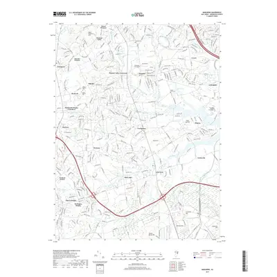
2019 Map of Marlboro
USGS Topo · Published 2019About this map
Colts Neck and the surrounding Monmouth County interior are defined by a complex network of equestrian properties and historic hamlets. The landscape is characterized by prominent elevations such as Sugar Loaf Hill and Cranberry Hill, which overlook a intricate drainage system including Big Brook, Yellow Brook, and the expansive Hockhockson Swamp. This survey documents a mix of agricultural heritage and suburban transition, with long-standing family landmarks like Smock Family Cem and Conover Cem situated near modern educational hubs like Brookdale Community College.
Find a feature on this map
51 named features on this map. Tap any name to fly to it.
Don’t see what you’re looking for? This feature index may not catch every label — zoom into the map to look around manually.
Map Details
Editions of this 2019 Marlboro Map
This is the sole edition of this map. No revisions or reprints were ever made.
Other maps of this area

1888 · New Brunswick
USGS Topo · 1:62,500

1888 · Asbury Park
USGS Topo · 1:62,500

1888 · Cassville
USGS Topo · 1:62,500

1888 · Sandy Hook
USGS Topo · 1:62,500

1893 · New Brunswick
USGS Topo · 1:62,500

1893 · Sandy Hook
USGS Topo · 1:62,500

1893 · Asbury Park
USGS Topo · 1:62,500

1894 · Cassville
USGS Topo · 1:62,500

1900 · Cassville
USGS Topo · 1:62,500

1901 · New Brunswick
USGS Topo · 1:62,500
Featured Places
- Middletown Township, NJ
- Howell Township, NJ
- Marlboro Township, NJ
- Freehold Township, NJ
- Wall Township, NJ