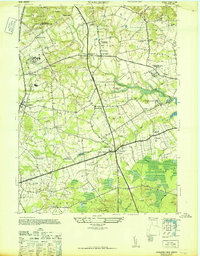
1947 Map of Marlboro
USGS Topo · Published 1947About this map
Monmouth County's agricultural landscape is captured here in the mid-1940s, revealing a region defined by established estates and specialized institutions. The northern portion of the map is dominated by the Mount Pleasant Hills and several significant properties, including the Colliers Foundation (School for Wayward Girls) and the expansive Marlboro State Hospital for the Insane. This era shows a community in transition from traditional farming to a landscape of notable landmarks like the Phalanx Cannery and Lairds Distillery near Scobeyville.
Find a feature on this map
59 named features on this map. Tap any name to fly to it.
Don’t see what you’re looking for? This feature index may not catch every label — zoom into the map to look around manually.
Map Details
Editions of this 1947 Marlboro Map
This is the sole edition of this map. No revisions or reprints were ever made.
Other maps of this area

1888 · New Brunswick
USGS Topo · 1:62,500

1888 · Asbury Park
USGS Topo · 1:62,500

1888 · Cassville
USGS Topo · 1:62,500

1888 · Sandy Hook
USGS Topo · 1:62,500

1893 · New Brunswick
USGS Topo · 1:62,500

1893 · Sandy Hook
USGS Topo · 1:62,500

1893 · Asbury Park
USGS Topo · 1:62,500

1894 · Cassville
USGS Topo · 1:62,500

1900 · Cassville
USGS Topo · 1:62,500

1901 · New Brunswick
USGS Topo · 1:62,500
Featured Places
- Middletown Township, NJ
- Howell Township, NJ
- Marlboro Township, NJ
- Freehold Township, NJ
- Wall Township, NJ