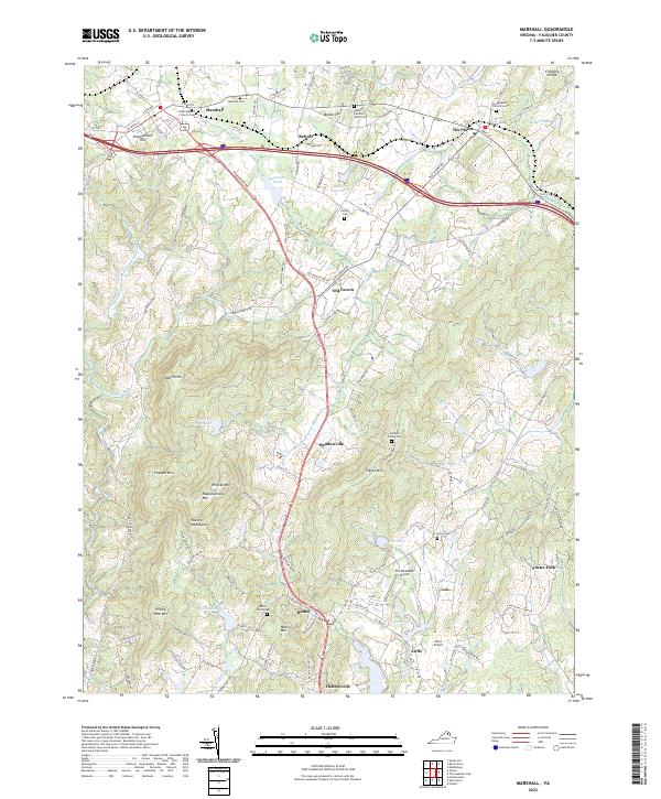
2022 Map of Marshall
USGS Topo · Published 2022About this map
Marshall and The Plains anchor this survey of Fauquier County, where the Piedmont landscape begins its ascent toward the Blue Ridge. The area is defined by a network of historic settlements and rural estates, including Belvoir, Old Tavern, and Meadowville. The terrain is punctuated by significant rises such as Wildcat Mtn and Rappahannock Mtn, part of the Watery Mountains range. Transportation corridors have shaped the region's development, from the Norfolk Southern railway to the prominent path of Winchester RD.
Find a feature on this map
121 named features on this map. Tap any name to fly to it.
Don’t see what you’re looking for? This feature index may not catch every label — zoom into the map to look around manually.
Map Details
Editions of this 2022 Marshall Map
This is the sole edition of this map. No revisions or reprints were ever made.
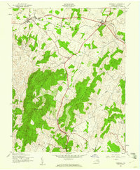
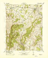
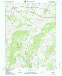
Historical Maps of Old Tavern Through Time
4 maps found