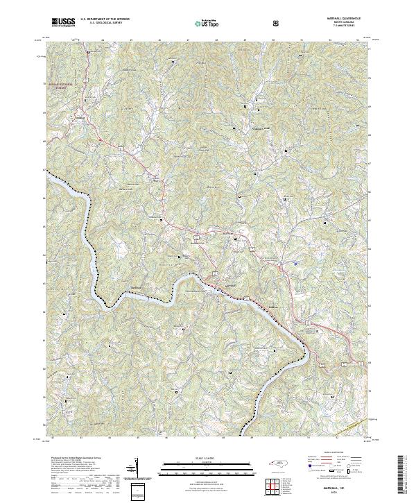
2022 Map of Marshall
USGS Topo · Published 2022About this map
The French Broad River carves a deep path through Madison County, centering on the town of Marshall and the distinctive Blennerhassett Island. This landscape is defined by its dramatic elevation changes, moving from the river banks up to prominent heights like High Rock and Pilot Knob. The western edge of the area is buffered by the Pisgah National Forest, while the interior is a network of ridges including Appletree Ridge and Sevenmile Ridge. Settlement patterns follow the winding creek valleys, with communities such as Walnut Creek and Redmon established near reliable water sources.
Find a feature on this map
187 named features on this map. Tap any name to fly to it.
Don’t see what you’re looking for? This feature index may not catch every label — zoom into the map to look around manually.
Map Details
Editions of this 2022 Marshall Map
This is the sole edition of this map. No revisions or reprints were ever made.
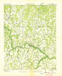
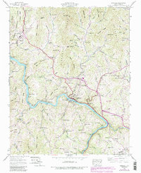
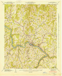
Historical Maps of Marshall Through Time
4 maps found