2021 Map of Marthasville
USGS Topo · Published 2021About this map
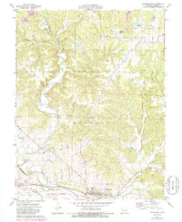
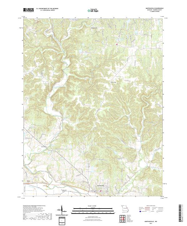
Marthasville and the nearby settlement of Peers anchor this study of the Missouri River valley and its northern ridges. The landscape is defined by the flat expanse of La Charrette Bottom along the river's edge, transitioning into a dense network of bluffs and ridges. Major topographic features include the prominent Tuque Ridge, Blackberry Ridge, and the distinct formation known as Grand Canyon. Numerous water sources crisscross the terrain, from Bagemann Spring to the winding courses of Charrette Creek and Tuque Cr. To the north, the modern development around Innsbrook is marked by a concentration of residential roads and water bodies like Wonder Lake. The map reveals a clear distinction between the agricultural bottomlands and the dissected upland ridges that dominate the central part of the quadrangle.
Find a feature on this map
95 named features on this map. Tap any name to fly to it.
Don’t see what you’re looking for? This feature index may not catch every label — zoom into the map to look around manually.
Map Details
Editions of this 2021 Marthasville Map
This is the sole edition of this map. No revisions or reprints were ever made.