2023 Map of Martin
USGS Topo · Published 2023About this map
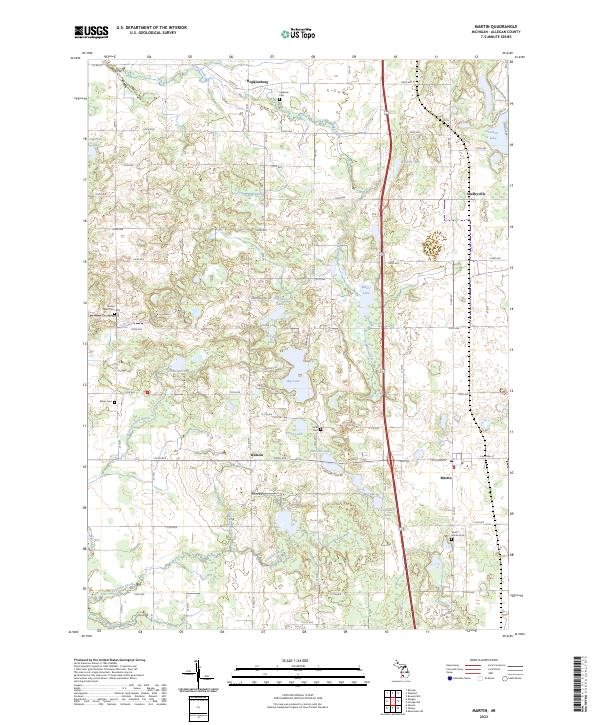
The settlement of Martin and the surrounding Allegan County countryside are defined by a complex network of glacial lakes and agricultural drainage systems. This 2023 survey records the rural layout of townships T3N R12W and T3N R11W, where the landscape is punctuated by water bodies with distinctive local names such as Shagnasty Lake, Big Lake, and Pickerel Lake. For genealogists and local historians, the map is an excellent resource for locating family burial sites across several townships, including Sacred Heart Cem, Miner Cem, and Ingerson Cem. Beyond the primary village centers of Shelbyville and Watson, the terrain is marked by smaller watercourses like Miller Creek and Schnable Brook, showing the ongoing importance of the local watershed to this farming and residential region north of Kalamazoo.
Find a feature on this map
56 named features on this map. Tap any name to fly to it.
Don’t see what you’re looking for? This feature index may not catch every label — zoom into the map to look around manually.
Map Details
Editions of this 2023 Martin Map
This is the sole edition of this map. No revisions or reprints were ever made.
Historical Maps of Otsego Township Through Time
Featured Locations
- Watson, MI
- Gun Plain Charter Township, MI
- Wayland Township, MI
- Otsego Township, MI
- Martin, Martin Township