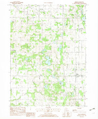
1982 Map of Martin
USGS Topo · Published 1982About this map
Martin and Shelbyville anchor the eastern corridor of this Allegan County landscape, where the Conrail rail line runs parallel to the main highway. The terrain is defined by a dense concentration of glacial kettle lakes and wetlands, ranging from the large Big Lake and Selkirk Lake to smaller named water bodies like Shagnasty Lake and Buskirk Lake. This 1982 provisional survey captures the rural character of the region as it transitioned into the late 20th century, balanced between agriculture and recreational hubs.
Find a feature on this map
33 named features on this map. Tap any name to fly to it.
Don’t see what you’re looking for? This feature index may not catch every label — zoom into the map to look around manually.
Map Details
Editions of this 1982 Martin Map
This is the sole edition of this map. No revisions or reprints were ever made.
Other maps of this area

1916 · Kalamazoo
USGS Topo · 1:62,500

1918 · Kalamazoo
USGS Topo · 1:62,500

1943 · Kalamazoo
USGS Topo · 1:62,500

1946 · Gobles
USGS Topo · 1:62,500

1948 · Gobles
USGS Topo · 1:62,500

1949 · Gobles
USGS Topo · 1:62,500

1958 · Allegan
USGS Topo · 1:62,500

1958 · Grand Rapids
USGS Topo · 1:250,000

1959 · Wayland
USGS Topo · 1:62,500

1961 · Grand Rapids
USGS Topo · 1:250,000