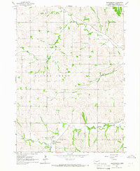
1964 Map of Martinsburg
USGS Topo · Published 1966About this map
Martinsburg sits at the southern edge of this mid-1960s topographical study, positioned where the Daily Branch meets the higher ground of Galena township. The landscape is defined by the winding paths of Silver Creek and South Creek, which carve through the loess hills of northeast Nebraska. This area was intensely settled by rural farmsteads, evidenced by the high density of country schools and churches that served as community anchors.
Find a feature on this map
21 named features on this map. Tap any name to fly to it.
Don’t see what you’re looking for? This feature index may not catch every label — zoom into the map to look around manually.
Map Details
Editions of this 1964 Martinsburg Map
This is the sole edition of this map. No revisions or reprints were ever made.
Other maps of this area

1898 · Elk Point
USGS Topo · 1:125,000

1901 · Elk Point
USGS Topo · 1:125,000

1907 · Elk Point
USGS Topo · 1:125,000

1955 · Sioux City
USGS Topo · 1:250,000

1958 · Sioux City
USGS Topo · 1:250,000

1959 · Sioux City
USGS Topo · 1:250,000

1963 · Elk Point
USGS Topo · 1:24,000

1964 · Martinsburg SW
USGS Topo · 1:24,000

1964 · Burbank
USGS Topo · 1:24,000

1964 · Maskell
USGS Topo · 1:24,000
Featured Places
- Martinsburg, NE
- Wakefield Township, NE
- Ottercreek Township, NE
- Newcastle Township, NE
- Silvercreek Township, NE