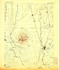
1894 Map of Marysville
USGS Topo · Published 1894About this map
The Marysville Buttes rise sharply from the Sacramento Valley floor, forming the central landmark of this late nineteenth-century landscape. This survey documents a critical junction of river and rail commerce, where the Oregon Division Central Pacific Railroad and the California Northern Railroad intersect near the burgeoning centers of Marysville and Yuba City. The map reveals an intricate network of waterways and early infrastructure, from the M. V. & O. Canal to numerous river crossings like Moons Ferry and Eddys Ferry.
Find a feature on this map
72 named features on this map. Tap any name to fly to it.
Don’t see what you’re looking for? This feature index may not catch every label — zoom into the map to look around manually.
Map Details
Editions of this 1894 Marysville Map
This is the sole edition of this map. No revisions or reprints were ever made.
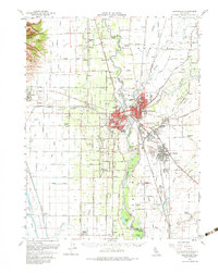
Historical Maps of Yuba City Through Time
5 maps found