2022 Map of Matheson
USGS Topo · Published 2022About this map
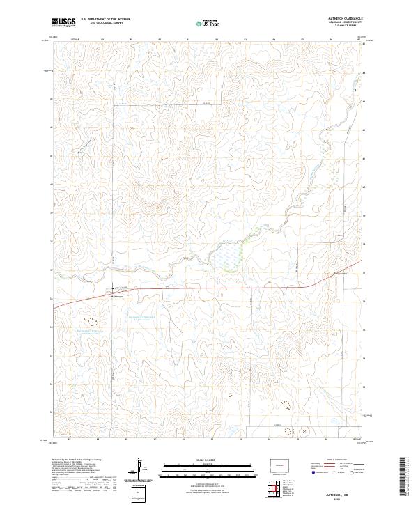
Matheson serves as the central hub of this eastern Colorado landscape, situated along the crossroads of Broadway Ave and Co RD 149. The topography is defined by the winding course of Big Sandy Creek, which meanders through the heart of the region, flanked by prominent elevations like Matheson Hill. Water management is a primary feature of the local geography, evidenced by the Big Sandy Cr Watershed S-22 Reservoir and the S-23 Reservoir located just south of the main settlement. The surrounding terrain is dissected by seasonal drainages such as Willow Gulch to the northwest and N Rush Cr in the southeast. A network of rural routes, including Resolus Rd and Co RD 102, provides a clear view of the property divisions and infrastructure serving this prairie community.
Find a feature on this map
22 named features on this map. Tap any name to fly to it.
Don’t see what you’re looking for? This feature index may not catch every label — zoom into the map to look around manually.
Map Details
Editions of this 2022 Matheson Map
This is the sole edition of this map. No revisions or reprints were ever made.