2024 Map of Mayo
USGS Topo · Published 2024About this map
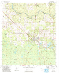
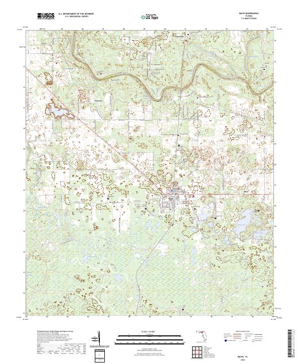
The Suwannee River carves a winding path along the border of Suwannee and Lafayette counties, anchoring a landscape defined by its distinctive karst topography and riverine settlements. In Mayo, the Lafayette County Courthouse stands as a central landmark for the region, while the surrounding countryside is dotted with small communities like Alton, Peterson, and Luraville. This 2024 survey reveals a dense network of local history, preserved through numerous burial sites such as Bethel Cem, Wayfare Cem, and the Luraville Baptist Church Cem. The terrain south of the river is characterized by an intricate system of ponds and sloughs, including Long Pond and Tenmile Pond, illustrating the hydrology of the Florida panhandle. Notable natural features like Telford Spring and Peacock Springs indicate the area's geological character, while The Trails Airport and the path of the Old Rail Rd mark the evolution of local transportation.
Find a feature on this map
141 named features on this map. Tap any name to fly to it.
Don’t see what you’re looking for? This feature index may not catch every label — zoom into the map to look around manually.
Map Details
Editions of this 2024 Mayo Map
This is the sole edition of this map. No revisions or reprints were ever made.