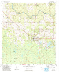
1955 Map of Mayo
USGS Topo · Published 1993About this map
Mayo serves as the focal point of this North Florida landscape, where the town grid is bounded by a network of rural roads and the Old Railroad Grade tracing toward the northeast. The Suwannee River snakes across the northern portion of the quadrangle, defining the border between Suwannee and Lafayette counties. This river corridor is rich with hydrological features, including Bonnet Spring, Peacock Springs, and Tilford Spring, which highlight the karst topography of the region. Scattered throughout the surrounding timberlands and wetlands are small settlements like Luraville and Alton. Local history is preserved in sites such as Bethel Cem and New Hope Ch, while the industrial past is visible in several quarries and the rail spur at San Pedro Junction. Extensive wetlands like Bear Bay and Double Run Bay dominate the southern reaches, illustrating the natural drainage patterns of the Lafayette interior.
Find a feature on this map
36 named features on this map. Tap any name to fly to it.
Don’t see what you’re looking for? This feature index may not catch every label — zoom into the map to look around manually.
Map Details
Editions of this 1955 Mayo Map
2 editions found
Other maps of this area

1954 · Mallory Swamp NW
USGS Topo · 1:24,000

1954 · Day SE
USGS Topo · 1:24,000

1954 · Day
USGS Topo · 1:24,000

1954 · Cooks Hammock
USGS Topo · 1:24,000

1954 · Dowling Park
USGS Topo · 1:24,000

1954 · Mallory Swamp NE
USGS Topo · 1:24,000

1954 · Gainesville
USGS Topo · 1:250,000

1954 · Valdosta
USGS Topo · 1:250,000

1955 · Mayo NE
USGS Topo · 1:24,000

1955 · Mayo
USGS Topo · 1:24,000