
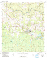
1955 Map of Mayo
USGS Topo · Published 1956About this map
The Suwannee River carves a winding path along the northern boundary of this mid-1950s survey, marking the transition between Suwannee and Lafayette counties. At the heart of the map lies Mayo, the county seat, where the Southern railway line intersects the local road network. To the east, the community of Alton is surrounded by a cluster of cemeteries and wetlands, including Alton Lake and the Alton Cem. The landscape is characterized by its numerous natural springs and ponds, such as Peacock Springs and Winburn Lake, which punctuate the low-lying terrain of Bear Bay and Coon Bay. This record preserves the location of rural landmarks from a period of local agricultural and timber stability, including the Mayo Lookout Tower and several remote church sites like New Hope Ch. A trace of an Old Railroad Grade running through the east suggests the shifting infrastructure of the Florida interior during the early 20th century.
Find a feature on this map
39 named features on this map. Tap any name to fly to it.
Don’t see what you’re looking for? This feature index may not catch every label — zoom into the map to look around manually.
Map Details
Editions of this 1955 Mayo Map
2 editions found
Other maps of this area

1954 · Mallory Swamp NW
USGS Topo · 1:24,000

1954 · Day SE
USGS Topo · 1:24,000

1954 · Day
USGS Topo · 1:24,000

1954 · Cooks Hammock
USGS Topo · 1:24,000

1954 · Dowling Park
USGS Topo · 1:24,000

1954 · Mallory Swamp NE
USGS Topo · 1:24,000

1954 · Gainesville
USGS Topo · 1:250,000

1954 · Valdosta
USGS Topo · 1:250,000

1955 · Mayo NE
USGS Topo · 1:24,000

1955 · Mayo SE
USGS Topo · 1:24,000