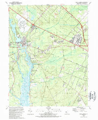
1989 Map of Mays Landing
USGS Topo · Published 1989About this map
Mays Landing sits at the head of the Egg Harbor River, serving as a focal point for Atlantic County's inland development. By the late 1980s, the landscape reflects a mix of institutional growth and recreational industry, notably marked by the sprawling Atlantic City Racetrack and Atlantic Community College. The transition from the area's agricultural past is evident in the presence of the Atlantic Blueberry Co Airstrip and numerous Claypit excavations, while the West Jersey and Seashore Railroad corridor highlights the region's historical transit backbone.
Find a feature on this map
67 named features on this map. Tap any name to fly to it.
Don’t see what you’re looking for? This feature index may not catch every label — zoom into the map to look around manually.
Map Details
Editions of this 1989 Mays Landing Map
This is the sole edition of this map. No revisions or reprints were ever made.
Other maps of this area

1890 · Great Egg Harbor
USGS Topo · 1:62,500

1890 · Hammonton
USGS Topo · 1:62,500

1890 · Tuckahoe
USGS Topo · 1:62,500

1890 · Mullica
USGS Topo · 1:62,500

1893 · Great Egg Harbor
USGS Topo · 1:62,500

1893 · Tuckahoe
USGS Topo · 1:62,500

1894 · Hammonton
USGS Topo · 1:62,500

1894 · Mullica
USGS Topo · 1:62,500

1898 · Mullica
USGS Topo · 1:62,500

1898 · Hammonton
USGS Topo · 1:62,500
Featured Places
- Egg Harbor Township, NJ
- Galloway Township, NJ
- Hamilton Township, NJ
- Weymouth Township, NJ
- Estell Manor, NJ