Loading...
Loading map...2023 Map of McCutchenville
USGS Topo · Published 2023About this map
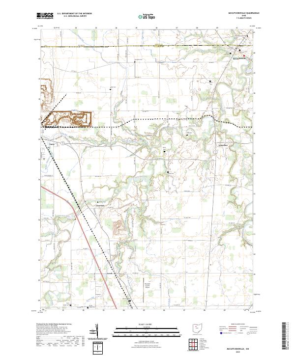
McCutchenville sits at the northern edge of this agricultural landscape, straddling the border between Seneca and Wyandot counties. The area is defined by the winding course of the Sandusky River to the east and the extensive drainage network of Tymochtee Creek and the Little Tymochtee Creek to the south. This modern survey illustrates a rural region where small settlements like Lovell, Crawford, and Tymochtee are connected by a dense grid of township roads.
Find a feature on this map
83 named features on this map. Tap any name to fly to it.
Don’t see what you’re looking for? This feature index may not catch every label — zoom into the map to look around manually.
Map Details
Date Portrayed2023
Date Published2023
PublisherU.S. Geological Survey
Map TypeTopographic
Scale1:24000
Physical Dimensions24 x 29 inches
Editions of this 2023 McCutchenville Map
This is the sole edition of this map. No revisions or reprints were ever made.
Historical Maps of McCutchenville Through Time
1 maps found
Featured Locations
- Tymochtee Township, OH
- Crane Township, OH
- Carey, Crawford Township
- Crawford, Crawford Township
- Tymochtee, Tymochtee Township
Source Details
SourceU.S. Geological Survey
CopyrightPublic Domain