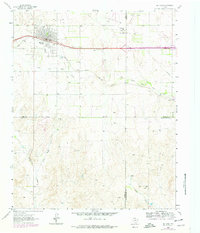
1963 Map of McLean
USGS Topo · Published 1978About this map
McLean serves as the focal point for this 1963 survey, a Texas Panhandle community positioned at the intersection of livestock culture and transportation infrastructure. The town's layout is defined by the Chicago Rock Island and Pacific railroad and features characteristic mid-century amenities, including a Drive-in Theater, a Golf Course, and the Rodeo Ground situated near the town center. Local history is anchored at the Hillcrest Cem on the northern edge of the settlement.
Find a feature on this map
20 named features on this map. Tap any name to fly to it.
Don’t see what you’re looking for? This feature index may not catch every label — zoom into the map to look around manually.
Map Details
Editions of this 1963 McLean Map
2 editions found
Other maps of this area

1954 · Amarillo
USGS Topo · 1:250,000

1958 · Amarillo
USGS Topo · 1:250,000

1959 · Troublesome Creek
USGS Topo · 1:24,000

1959 · Spencer Lake
USGS Topo · 1:24,000

1962 · Hudgens Ranch
USGS Topo · 1:24,000

1962 · Back
USGS Topo · 1:24,000

1962 · Pakan
USGS Topo · 1:24,000

1963 · Alanreed
USGS Topo · 1:24,000

1963 · Ramsdell
USGS Topo · 1:24,000

1963 · McLean
USGS Topo · 1:24,000