2023 Map of Mead
USGS Topo · Published 2023About this map
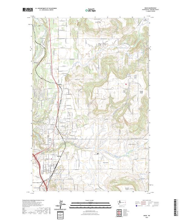
The Mead area of Spokane County is defined by a landscape of distinct upland bluffs and sprawling agricultural prairies. The Little Spokane River cuts through the northwest corner of the sheet near Buckeye, while the higher elevations of Orchard Bluff and Green Bluff rise above the surrounding terrain. This modern survey shows a mosaic of residential development and agricultural land use, particularly around the settlement of Colbert and the expanding residential pockets of Sunshine Acres. Aviation history is present through the Mead Flying Service and the Boyle R & D Airport, reflecting the region's relationship with open space. Local heritage is preserved at sites like Evergreen Cem and Peone Cem, which serve as quiet markers of the community's long-standing presence on Peone Prairie.
Find a feature on this map
65 named features on this map. Tap any name to fly to it.
Don’t see what you’re looking for? This feature index may not catch every label — zoom into the map to look around manually.
Map Details
Editions of this 2023 Mead Map
This is the sole edition of this map. No revisions or reprints were ever made.