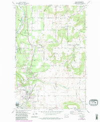
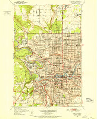
1973 Map of Mead
USGS Topo · Published 1986About this map
Peone Prairie and the surrounding bluffs define the landscape of this region north of Spokane, where agriculture and early transportation networks converged. The Burlington Northern railroad serves as a central spine through the valley, passing near established nodes like Colbert and Buckeye. Industrial and community life is anchored by facilities such as the Grain Elevator in Mead and the Mater Cleri Seminary near the base of the bluffs. The map preserves the location of the Indian Treaty Tree and the Peone Cem, offering significant markers for local heritage and genealogy.
Find a feature on this map
83 named features on this map. Tap any name to fly to it.
Don’t see what you’re looking for? This feature index may not catch every label — zoom into the map to look around manually.
Map Details
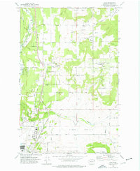
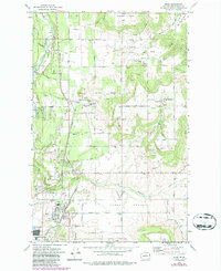
Editions of this 1973 Mead Map
3 editions found
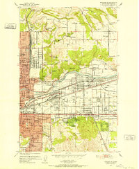
Other maps of this area

1901 · Spokane
USGS Topo · 1:125,000

1943 · Mt Spokane
USGS Topo · 1:62,500

1949 · Deer Park
USGS Topo · 1:62,500

1949 · Greenacres
USGS Topo · 1:62,500
1950 · Spokane NE
USGS Topo · 1:24,000

1950 · Mt Spokane
USGS Topo · 1:62,500
1950 · Spokane NW
USGS Topo · 1:24,000

1950 · Spokane
USGS Topo · 1:62,500
1951 · Deer Park
USGS Topo · 1:62,500

1951 · Greenacres
USGS Topo · 1:62,500