2023 Map of Meadow Bridge
USGS Topo · Published 2023About this map
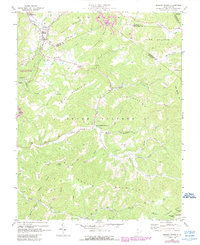
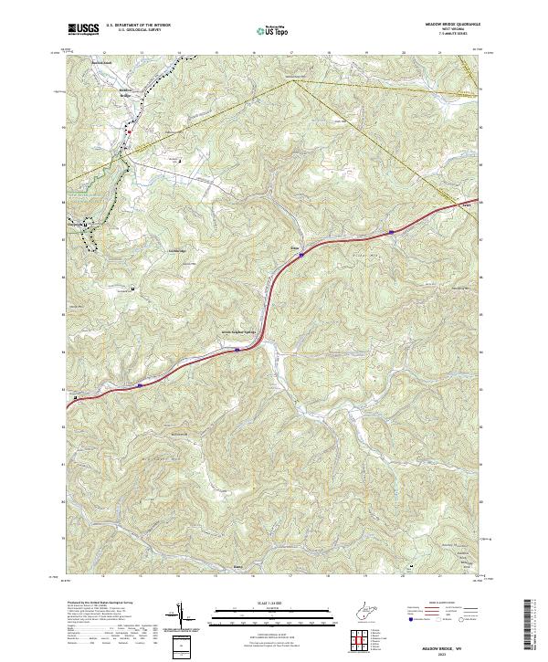
Green Sulphur Springs lies at the intersection of local mountain roads and watercourses in this high-altitude section of the Allegheny Plateau. The landscape is defined by its series of prominent knobs and mountains, including Buffalo Knob, Big Swell Mtn, and Kenney Mountain. This survey illustrates the settlement patterns of a region where community life historically clustered around natural features like Harless Spring and the drainage of Meadow Creek. To the west, the map includes a portion of the New River Gorge National River, while the rest of the quadrangle is dotted with small mountain hamlets such as Beelick Knob, Lawn, and Ramp. For the genealogist, the inclusion of remote family burial grounds like Wickline Cem and DeQuasie Cem provides essential spatial context for tracing local family lines through the hollows of Fayette Co, Summers Co, and Greenbrier Co.
Find a feature on this map
106 named features on this map. Tap any name to fly to it.
Don’t see what you’re looking for? This feature index may not catch every label — zoom into the map to look around manually.
Map Details
Editions of this 2023 Meadow Bridge Map
This is the sole edition of this map. No revisions or reprints were ever made.