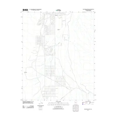
2011 Map of Meadview South
USGS Topo · Published 2011About this map
Grapevine Mesa defines the high-desert topography of this Mohave County region, where the planned community of Meadview serves as a gateway to the surrounding wilderness. The 2011 survey reveals a complex grid of residential streets extending south from the main settlement, including Escalante Dr and Saddleback Rd, reflecting the area's development as a retirement and recreation hub. The landscape is marked by unique viewpoints such as Carlos Elmer's Joshua View, highlighting the local botanical significance of the Joshua tree forests. Significant infrastructure is visible in the form of the Water Line, which underscores the challenges of water management in this arid environment. Key transit corridors like Diamond Bar Rd and River Rd connect the isolated residential pockets to the broader Mohave landscape, providing a clear picture of rural Arizona land use in the early 21st century.
Find a feature on this map
80 named features on this map. Tap any name to fly to it.
Don’t see what you’re looking for? This feature index may not catch every label — zoom into the map to look around manually.
Map Details
Editions of this 2011 Meadview South Map
This is the sole edition of this map. No revisions or reprints were ever made.
Other maps of this area

1886 · Diamond Creek
USGS Topo · 1:250,000

1886 · Camp Mohave
USGS Topo · 1:250,000

1886 · Saint Thomas
USGS Topo · 1:250,000

1886 · Mt. Trumbull
USGS Topo · 1:250,000

1892 · Diamond Creek
USGS Topo · 1:250,000

1892 · Mt. Trumbull
USGS Topo · 1:250,000

1892 · Camp Mohave
USGS Topo · 1:250,000

1893 · Saint Thomas
USGS Topo · 1:250,000

1926 · Bonelli
USGS Topo · 1:96,000

1942 · Camp Mohave
USGS Topo · 1:250,000