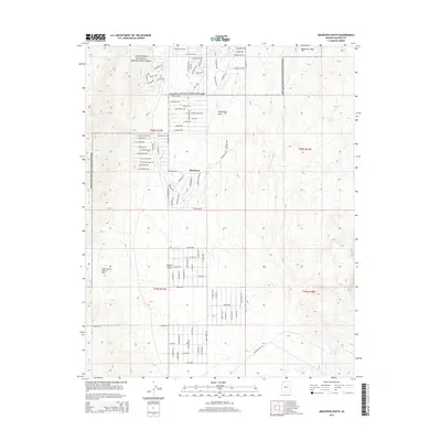
2014 Map of Meadview South
USGS Topo · Published 2014About this map
Meadview serves as a residential outpost at the edge of the Mojave Desert, where the high desert plateau meets the expansive reaches of the Lake Mead National Recreation Area. The settlement is characterized by a sprawling grid of desert roads with names reflecting the recreational and historical character of the region, such as Boathouse Dr, Starlight Way, and Queen Tut Dr. To the east, the terrain rises toward Grapevine Mesa, a prominent landform overlooking the Grapevine Wash. The southwestern corner of the quadrangle includes the unique Carlos Elmer's Joshua View, highlighting the specific floral character of this Mohave County landscape. The map captures the specialized development of this remote community, established to provide access to the surrounding federal recreation lands.
Find a feature on this map
92 named features on this map. Tap any name to fly to it.
Don’t see what you’re looking for? This feature index may not catch every label — zoom into the map to look around manually.
Map Details
Editions of this 2014 Meadview South Map
This is the sole edition of this map. No revisions or reprints were ever made.
Other maps of this area

1886 · Diamond Creek
USGS Topo · 1:250,000

1886 · Camp Mohave
USGS Topo · 1:250,000

1886 · Saint Thomas
USGS Topo · 1:250,000

1886 · Mt. Trumbull
USGS Topo · 1:250,000

1892 · Diamond Creek
USGS Topo · 1:250,000

1892 · Mt. Trumbull
USGS Topo · 1:250,000

1892 · Camp Mohave
USGS Topo · 1:250,000

1893 · Saint Thomas
USGS Topo · 1:250,000

1926 · Bonelli
USGS Topo · 1:96,000

1942 · Camp Mohave
USGS Topo · 1:250,000