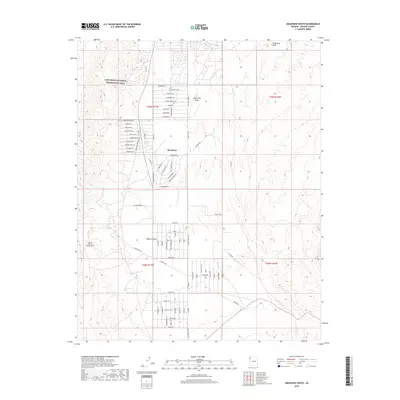
2018 Map of Meadview South
USGS Topo · Published 2018About this map
Meadview serves as the central hub of this Mohave County landscape, situated on the high grounds of Grapevine Mesa. The settlement pattern is defined by a dense network of residential streets with nautical and western-themed names like Boathouse Dr and Bighorn Dr, reflecting its position as a gateway to the nearby Lake Mead National Recreation Area. The infrastructure reveals the challenges of the arid Mojave Desert, prominently featuring an extensive Waterline system that snakes across the desert floor to support the community.
Find a feature on this map
84 named features on this map. Tap any name to fly to it.
Don’t see what you’re looking for? This feature index may not catch every label — zoom into the map to look around manually.
Map Details
Editions of this 2018 Meadview South Map
This is the sole edition of this map. No revisions or reprints were ever made.
Other maps of this area

1886 · Diamond Creek
USGS Topo · 1:250,000

1886 · Camp Mohave
USGS Topo · 1:250,000

1886 · Saint Thomas
USGS Topo · 1:250,000

1886 · Mt. Trumbull
USGS Topo · 1:250,000

1892 · Diamond Creek
USGS Topo · 1:250,000

1892 · Mt. Trumbull
USGS Topo · 1:250,000

1892 · Camp Mohave
USGS Topo · 1:250,000

1893 · Saint Thomas
USGS Topo · 1:250,000

1926 · Bonelli
USGS Topo · 1:96,000

1942 · Camp Mohave
USGS Topo · 1:250,000