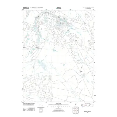
2011 Map of Medford Lakes
USGS Topo · Published 2011About this map
Medford Lakes serves as a focal point for this area of the New Jersey Pine Barrens, defined by an intricate network of residential lake communities and historic water management. The legacy of colonial and early American industry is visible at Braddocks Mill and the nearby Braddocks Millpond, while the regional agricultural heritage is represented by the West Jersey Cranberry Meadow. To the south, the landscape transitions toward the Mullica River basin, featuring specialized recreation sites like Camp Lenape and the Atco Dragway. These developments are interspersed among natural landforms such as Stone Mountain and Jackson Hill, illustrating the balance between suburban expansion and the preservation of the unique local ecology during the early 21st century.
Find a feature on this map
77 named features on this map. Tap any name to fly to it.
Don’t see what you’re looking for? This feature index may not catch every label — zoom into the map to look around manually.
Map Details
Editions of this 2011 Medford Lakes Map
This is the sole edition of this map. No revisions or reprints were ever made.
Other maps of this area

1888 · Pemberton
USGS Topo · 1:62,500

1888 · Mount Holly
USGS Topo · 1:62,500

1890 · Hammonton
USGS Topo · 1:62,500

1890 · Mullica
USGS Topo · 1:62,500

1894 · Hammonton
USGS Topo · 1:62,500

1894 · Pemberton
USGS Topo · 1:62,500

1894 · Mount Holly
USGS Topo · 1:62,500

1894 · Mullica
USGS Topo · 1:62,500

1898 · Pemberton
USGS Topo · 1:62,500

1898 · Mount Holly
USGS Topo · 1:62,500