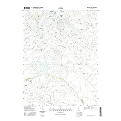
2016 Map of Medford Lakes
USGS Topo · Published 2016About this map
Medford Lakes and the surrounding Pine Barrens landscape are defined by an intricate network of man-made and natural water bodies. The settlement of Medford Lakes itself is centered around Lake Mishe-Mokwa and the Aetna lakes, showing a dense residential pattern integrated into the forest. Historically significant industrial and agricultural sites are scattered throughout, including Braddocks Mill near its associated Braddocks Millpond, and the expansive West Jersey Cranberry Meadow.
Find a feature on this map
174 named features on this map. Tap any name to fly to it.
Don’t see what you’re looking for? This feature index may not catch every label — zoom into the map to look around manually.
Map Details
Editions of this 2016 Medford Lakes Map
This is the sole edition of this map. No revisions or reprints were ever made.
Other maps of this area

1888 · Pemberton
USGS Topo · 1:62,500

1888 · Mount Holly
USGS Topo · 1:62,500

1890 · Hammonton
USGS Topo · 1:62,500

1890 · Mullica
USGS Topo · 1:62,500

1894 · Hammonton
USGS Topo · 1:62,500

1894 · Pemberton
USGS Topo · 1:62,500

1894 · Mount Holly
USGS Topo · 1:62,500

1894 · Mullica
USGS Topo · 1:62,500

1898 · Pemberton
USGS Topo · 1:62,500

1898 · Mount Holly
USGS Topo · 1:62,500