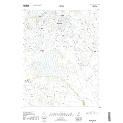
2019 Map of Medford Lakes
USGS Topo · Published 2019About this map
Medford Lakes and its surrounding residential communities occupy a landscape defined by an intricate network of waterways and managed impoundments. The geography is characterized by numerous named lakes and ponds, including Lake Pine, Papoose Lake, and Upper Stokes Pond, which are interconnected by drainages like Haynes Cr and Wesickaman Cr. The presence of Braddocks Mill and Indian Mills Sawmill Pond points to the area's legacy of water-powered industry, while the expansive West-Jersey Granberry Meadow indicates the historical importance of cranberry cultivation in this part of the Pine Barrens. The terrain is generally low-lying, though local elevations are marked by Jackson Hill, Stone Mtn, and Sharps Mtn. Smaller settlements such as Flyat and Dellette sit further east, transitioning into the denser wetlands surrounding the Mullica River.
Find a feature on this map
197 named features on this map. Tap any name to fly to it.
Don’t see what you’re looking for? This feature index may not catch every label — zoom into the map to look around manually.
Map Details
Editions of this 2019 Medford Lakes Map
This is the sole edition of this map. No revisions or reprints were ever made.
Other maps of this area

1888 · Pemberton
USGS Topo · 1:62,500

1888 · Mount Holly
USGS Topo · 1:62,500

1890 · Hammonton
USGS Topo · 1:62,500

1890 · Mullica
USGS Topo · 1:62,500

1894 · Hammonton
USGS Topo · 1:62,500

1894 · Pemberton
USGS Topo · 1:62,500

1894 · Mount Holly
USGS Topo · 1:62,500

1894 · Mullica
USGS Topo · 1:62,500

1898 · Pemberton
USGS Topo · 1:62,500

1898 · Mount Holly
USGS Topo · 1:62,500