2022 Map of Medora
USGS Topo · Published 2022About this map
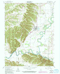
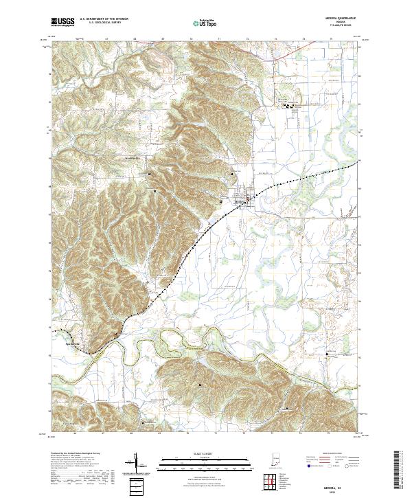
The East Fork White River and the Muscatatuck River define the hydrological character of this Jackson County landscape, where bottomlands meet the rising elevations of Byarlay Knob and Fleene Ridge. The town of Medora serves as a central hub, situated near the intricate drainage network of Singer Ditch and Hinderlider Ditch. This geography of water management is reflected in the numerous named ditches and hollows, such as Doulton Hollow and Shelton Hollow, which carve through the terrain between the river basins.
Find a feature on this map
69 named features on this map. Tap any name to fly to it.
Don’t see what you’re looking for? This feature index may not catch every label — zoom into the map to look around manually.
Map Details
Editions of this 2022 Medora Map
This is the sole edition of this map. No revisions or reprints were ever made.