Old Maps of Jackson County, Indiana
Explore 131 old maps of Jackson County, spanning from 1934 to today. These high-resolution historic maps reveal how streets, neighborhoods, landmarks, and natural features evolved over time — perfect for genealogy, metal detecting, research, and local history exploration.
What you can do with these maps:
- See how Jackson County changed over time: Compare historical maps to modern-day views to trace roads, homesites, rail lines & more.
- View detailed metadata: Each map includes creators, publishers, year, scale, and archive source.
- Overlay maps with satellite & LiDAR: Visualize the past alongside modern tools to explore terrain & human change.
- Trusted historical sources: Maps sourced from the USGS, Library of Congress, and other archives.
- Access maps your way: View online, download high-res files, or order prints for personal or research use.
Start exploring old maps of Jackson County to uncover forgotten places, hidden landmarks, and the deep history beneath your feet.
Jackson County, IN maps
(131)- 1934 Map of Bedford
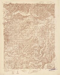 1934 Bedford1934 Print · USGSLawrence County's limestone district and the winding White River valley are detailed here during the mid-1930s. Genealogists and researchers can trace local families through many rural landmarks, including Sherril Cem, Leesville, and the Peerless Quarry.2 unique versions available
 - 1937 Map of Bedford
 1937 Bedford1937 Print · USGSLawrence County limestone country is seen here in the late 1930s, defined by its massive quarries and river-valley railroads. Genealogists can trace family landmarks and rural life at the County Farm, Leesville, and the United Brethren Ch.2 unique versions available
 - 1942 Map of Franklin
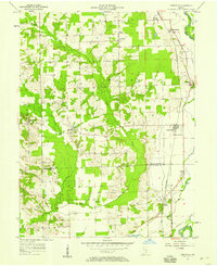
 1942 Franklin1942 Print · USGSCentral Indiana during the early years of the war shows a landscape of established rail towns and growing military installations. Genealogists can trace family names across small settlements like Nineveh, Bean Blossom, and Helmsburg, or locate the Indiana University Observatory.
 - 1942 Map of Columbus
 1942 Columbus1942 Print · USGSBartholomew and Shelby counties are shown during the early years of the war, as military installations and rail lines reshaped the rural Indiana landscape. Genealogists can trace family-named sites and established communities like St Louis Crossing, Hope, and the sprawling Camp Atterbury.
 - 1947 Map of Scottsburg
 1947 Scottsburg1947 Print · USGSScott County’s agricultural and rail corridor is meticulously detailed shortly after the war, centered on the growing hubs of Scottsburg and Austin. Genealogists can locate family landmarks such as New Providence Ch, Carlisle Sch, and the COUNTY FARM.2 unique versions available
 - 1947 Map of Elkinsville, 1961 Print
 1947 Elkinsville1961 Print · USGSBrown County and Monroe County are captured just after the war, showing the rural way of life along the forks of Salt Creek. Researchers can trace the layout of Elkinsville and Maumee, locating old landmarks like Chambers Bridge and Bethel Ch.
 - 1948 Map of Waymansville
 1948 Waymansville1948 Print · USGSBartholomew and Jackson counties appear here just after the war, showing a landscape of ridge-top schools and creek-bottom settlements. Researchers can trace the rural legacy of Waymansville and find local landmarks like Ohio Chapel, Taylor Chapel, and the St Paul Sch.2 unique versions available
 - 1950 Map of Elkinsville
 1950 Elkinsville1950 Print · USGSBrown County's rugged ridge-and-hollow terrain is captured here at mid-century, just as the local forest preserves were maturing. Genealogists and hikers can trace old family sites like Elkinsville Cem, Maumee Sch, and the Hickory Ridge Lookout Tower.
 - 1953 Map of Cincinnati, 1965 Print
 1953 Cincinnati1965 Print · USGSThe Ohio River valley and the industrial heartland of Indiana and Ohio are captured here during the mid-century peak of rail and river commerce. Genealogists and historians can trace connections between Cincinnati and outlying military sites like Camp Atterbury and Bakalar AFB.3 unique versions available
 - 1953 Map of Indianapolis, 1965 Print
 1953 Indianapolis1965 Print · USGSCentral Indiana and the Illinois borderlands are captured in the mid-sixties, showing the growth of Indianapolis and its industrial rail corridors. Genealogists and historians can trace the development of outlying towns like Zionsville or Beech Grove and find landmarks such as Atterbury AAF and Turkey Run State Park.4 unique versions available
 - 1956 Map of Indianapolis
 1956 Indianapolis1956 Print · USGSCentral Indiana in the mid-fifties is captured during a period of industrial growth and military presence. Genealogists and historians can trace the rail networks of the New York Central or locate regional landmarks like Fort Benjamin Harrison and Camp Atterbury.
 - 1956 Map of Story, 1957 Print
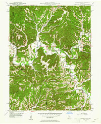
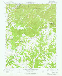
 1956 Story1957 Print · USGSThe hills of Brown and Jackson counties are captured here in the mid-1950s, showing a landscape of deep ridges and creek bottoms. Researchers can trace the Old Indian Treaty Boundary Line and locate local landmarks like Kirk Hill Ch and Story.2 unique versions available
 - 1956 Map of Vincennes, 1967 Print
 1956 Vincennes1967 Print · USGSSouthern Indiana and the Illinois borderlands are captured here in the mid-fifties, showing the region's dense network of river towns and rail lines. Researchers can trace historic river crossings along the Wabash River or locate landmarks like Wyandotte Cave and Lincoln State Park.4 unique versions available
 - 1956 Map of Louisville, 1971 Print
 1956 Louisville1971 Print · USGSThe Ohio River valley and the Kentucky Bluegrass are captured here during a period of rapid mid-century growth and industrial activity. Genealogists and historians can trace rail-centered towns and military land use at Fort Knox and the Jefferson Proving Ground.2 unique versions available
 - 1957 Map of Indianapolis
 1957 Indianapolis1957 Print · USGSCentral Indiana in the mid-fifties is captured here as a crossroads of major rail lines and nascent federal highways. Genealogists and historians can trace family-named ridges like Poplar Ridge or locate strategic sites like Camp Atterbury and Speedway.2 unique versions available
 - 1957 Map of Vincennes
 1957 Vincennes1957 Print · USGSSouthwest Indiana and the Illinois borderlands come alive in the late 1950s, a period of heavy rail traffic and expanding state forests. Genealogists and historians can trace the riverfronts and rail lines of Vincennes, New Harmony, and the vast Crane Naval Ammunition Depot.
 - 1957 Map of Cincinnati
 1957 Cincinnati1957 Print · USGSThe Ohio River valley and its surrounding highlands thrived during the mid-fifties industrial peak, centered on the bustling Cincinnati and Dayton metropolitan hubs. Researchers can trace the extensive rail networks and military sites like Wright-Patterson AFB and Camp Atterbury.
 - 1957 Map of Jonesville, 1958 Print
 1957 Jonesville1958 Print · USGSMid-century Bartholomew County and Jackson County life revolves around the East Fork White River and the local rail line. Genealogists and historians can trace the foundations of Jonesville and Waynesville or locate landmarks like Walker Chapel and St Johns Sch Cem.
 - 1957 Map of Azalia, 1958 Print
 1957 Azalia1958 Print · USGSIndiana's rural heartland is captured here in the late fifties at the intersection of Bartholomew, Jackson, and Jennings counties. Genealogists can trace family roots at Shed Creek Cem, the Friends Meetinghouse, and the small settlement of Reddington.4 unique versions available
 - 1958 Map of Vincennes
 1958 Vincennes1958 Print · USGSSouthern Indiana and the Illinois borderlands are captured during a mid-century period of heavy rail traffic and military activity. Researchers can trace the sprawling bounds of the Crane Naval Ammunition Depot or locate historic settlements like New Harmony and French Lick.2 unique versions available
 - 1958 Map of Norman, 1959 Print
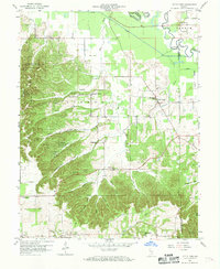
 1958 Norman1959 Print · USGSLawrence County in the late fifties shows a landscape of ridge-top settlements and national forest land. Genealogists and local historians can locate the small communities of Norman, Zelma, and Yellowstone, and trace the winding course of Salt Creek.4 unique versions available
 - 1958 Map of Little York, 1959 Print
 1958 Little York1959 Print · USGSWashington and Scott Counties are captured here in the late fifties, showcasing a rural Indiana landscape of ridge-top churches and forested hollows. Researchers can trace family sites at McKnight Cem, visit the settlement of Pumpkin Center, or locate the old Township Sch.6 unique versions available
 - 1958 Map of Brownstown, 1960 Print
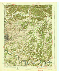
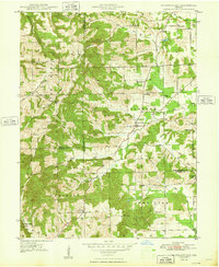
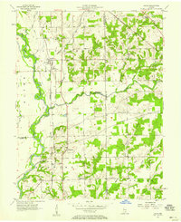
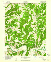
 1958 Brownstown1960 Print · USGSJackson County in the late 1950s centers on the industrial and rail hub of Brownstown as it borders the forested uplands. Researchers can locate vanished landmarks like the Brick Kilns, the historic Covered Bridge, and the Old Indian Treaty Boundary line.4 unique versions available
 - 1958 Map of Tunnelton, 1960 Print
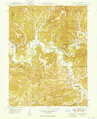
 1958 Tunnelton1960 Print · USGSLawrence County at the end of the fifties reveals a landscape shaped by the East Fork White River and the busy Baltimore and Ohio rail line. Genealogists and local historians can trace the foundations of Tunnelton, Fort Ritner, and remote landmarks like Devils Backbone.2 unique versions available
 - 1958 Map of Seymour, 1960 Print
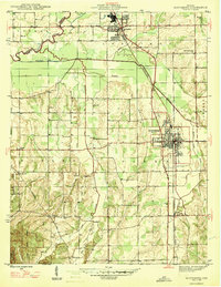
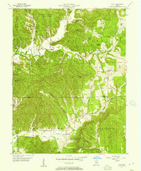
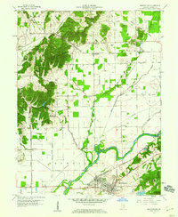
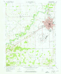 1958 Seymour1960 Print · USGSIn the late fifties, the railway crossroads at Seymour flourished alongside the East Fork White River. Genealogists and historians can trace the Old Indian Treaty Boundary and locate numerous family burial sites like Crane Cem and Durland Cem.5 unique versions available
Showing maps 1-25 of 131
Top cities of Jackson County
- Seymour historical maps
- Brownstown historical maps
- Crothersville historical maps
- Medora historical maps
Frequently asked questions
- What are the different types of historical maps available for Jackson County?
- What is the oldest map of Jackson County?
- Where can I purchase historical maps of Jackson County for my home or office?
- Where can I download high-res historical maps of Jackson County?
- Are there historical topographic maps available for Jackson County?
- Is there historical aerial imagery available for Jackson County?
- Where are historical maps of Jackson County sourced from?