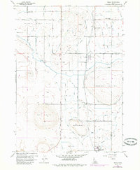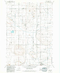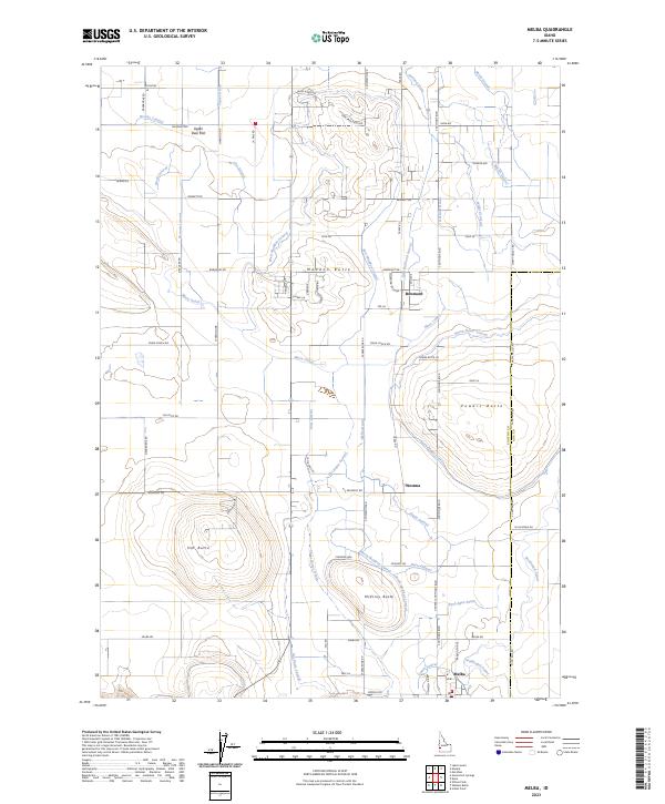
2023 Map of Melba
USGS Topo · Published 2023About this map
Melba anchors the southern portion of this Idaho landscape, where the high desert terrain of Canyon and Ada counties is defined by a complex network of agricultural irrigation. Prominent volcanic features like Hat Butte, McElroy Butte, and Powers Butte rise above the surrounding flats, serving as natural landmarks in an otherwise highly engineered environment. The human imprint is most evident in the extensive system of waterways, including the Mora Canal and Waldvogel Canal, which feed numerous lateral lines such as the North Power Lateral and South McElroy Lateral.
Find a feature on this map
114 named features on this map. Tap any name to fly to it.
Don’t see what you’re looking for? This feature index may not catch every label — zoom into the map to look around manually.
Map Details
Editions of this 2023 Melba Map
This is the sole edition of this map. No revisions or reprints were ever made.