2022 Map of Melvina
USGS Topo · Published 2022About this map
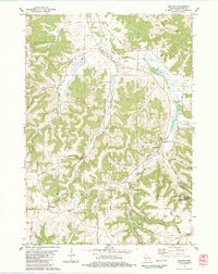
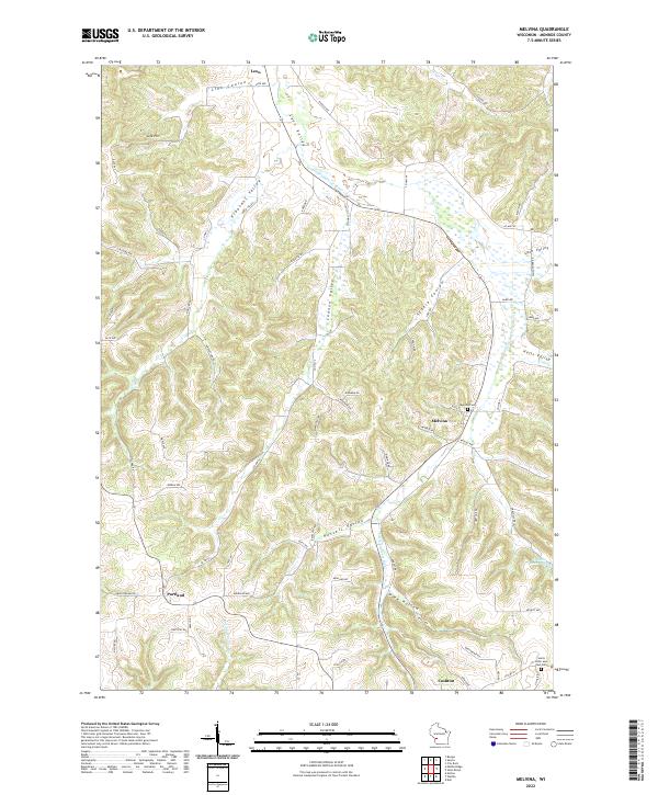
Melvina and the winding Little La Crosse River anchor this landscape in Monroe County, where the topography is defined by a dense network of coulees and valleys. The settlement pattern follows these natural corridors, with Leon situated at the head of Leon Valley and Portland positioned to the southwest. The intricate drainage system includes Link Coulee, Steele Coulee, and Russell Valley, reflecting the specialized landform terminology of the Driftless Area. Local history and genealogy interests are represented by sites such as the Melvina Cem and Saints Peter and Paul Cem, which sit near the southern edge of the survey area toward Cashton. The terrain is further marked by distinct landmarks like Link Hill and the Pinnacle Rock Pond, illustrating how the early road network, including routes like Co HWY X and Co HWY F, adapted to the narrow valleys and steep ridges of this Wisconsin region.
Find a feature on this map
74 named features on this map. Tap any name to fly to it.
Don’t see what you’re looking for? This feature index may not catch every label — zoom into the map to look around manually.
Map Details
Editions of this 2022 Melvina Map
This is the sole edition of this map. No revisions or reprints were ever made.