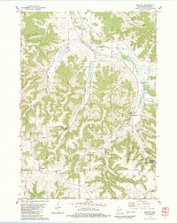
1983 Map of Melvina
USGS Topo · Published 1984About this map
Leon Valley and the surrounding unglaciated uplands of Monroe County are depicted here as they appeared in the early 1980s. The settlement of Melvina sits along the Little La Crosse River, served by the Chicago and North Western rail line. The landscape is defined by its deep coulees and ridges, including Dixon Coulee, Steele Coulee, and Cannon Valley, which dictate the winding paths of rural roads like Edgewood Avenue. Local history is anchored by sites such as Union Cem and Portland Ch, while the Pinnacle Rock State Fishery Area highlights the conservation of the region's spring-fed waters near Pinnacle Rock. This survey documents a rural Wisconsin community where agriculture and topography remain deeply intertwined, evidenced by the numerous quarries and sandpits scattered across the townships of Leon, Wells, Portland, and Jefferson.
Find a feature on this map
52 named features on this map. Tap any name to fly to it.
Don’t see what you’re looking for? This feature index may not catch every label — zoom into the map to look around manually.
Map Details
Editions of this 1983 Melvina Map
This is the sole edition of this map. No revisions or reprints were ever made.
Other maps of this area

1909 · Sparta
USGS Topo · 1:62,500

1916 · Tomah
USGS Topo · 1:62,500

1923 · Viroqua
USGS Topo · 1:62,500

1926 · Viroqua
USGS Topo · 1:62,500

1926 · La Farge
USGS Topo · 1:62,500

1947 · Sparta
USGS Topo · 1:62,500

1949 · Sparta
USGS Topo · 1:62,500

1949 · Tomah
USGS Topo · 1:62,500

1958 · La Crosse
USGS Topo · 1:250,000

1961 · La Crosse
USGS Topo · 1:250,000