
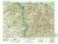
1958 Map of La Crosse
USGS Topo · Published 1979About this map
La Crosse anchors this 1978 revision, marking the confluence where the Black River meets the Mississippi River. The landscape is defined by the Coulee Region's distinctive ridges and bluffs, including Grandad Bluff and a series of named heights such as St. Joseph Ridge and Brush Ridge. This survey reveals the mid-century infrastructure of the Driftless Area, showing the extensive rail networks of the Chicago Milwaukee St Paul and Pacific and the Chicago and North Western as they navigate the river valleys.
Find a feature on this map
241 named features on this map. Tap any name to fly to it.
Don’t see what you’re looking for? This feature index may not catch every label — zoom into the map to look around manually.
Map Details
Editions of this 1958 La Crosse Map
2 editions found
Other maps of this area

1900 · Lancaster
USGS Topo · 1:125,000

1901 · Denzer
USGS Topo · 1:62,500

1901 · Oelwein
USGS Topo · 1:125,000

1901 · The Dells
USGS Topo · 1:62,500

1902 · Mineral Point
USGS Topo · 1:125,000

1902 · Elkader
USGS Topo · 1:125,000

1903 · Waukon
USGS Topo · 1:125,000

1904 · Lancaster
USGS Topo · 1:125,000

1905 · Richland Center
USGS Topo · 1:125,000

1906 · Decorah
USGS Topo · 1:125,000